Cold War Scotland
From 16-23 May 2025, The Cold War Network is bringing together historic sites across the UK for the first-ever Cold War National Heritage Week - a nationwide event dedicated to uncovering Britain’s Cold War history. Many physical remnants of this history are visible in imagery held by the National Collection of Aerial Photography, especially in coverage of Scotland.
Scotland occupies a stategic position between continental Europe and the North Atlantic, so was a key location during the Cold War. A variety of military installations were built there throughout the second half of the twentieth century. From submarine bases and airfields to military ports and nuclear bunkers, traces of Cold War construction can be seen throughout Scotland and are also visible across the National Collection of Aerial Photography (NCAP).
The Cold War
The Cold War was a period of sustained political and military tension which existed between the USA and the Soviet Union – supported by their allies – from 1947-1991. Western powers were primarily represented by The North Atlantic Treaty Organisation (NATO), founded in 1949 and consisting of the USA, Canada, the United Kingdom and nine other European nations. As a response to NATO, in 1955 the Warsaw Pact was formed between the Soviet Union and seven Eastern Bloc socialist republics.
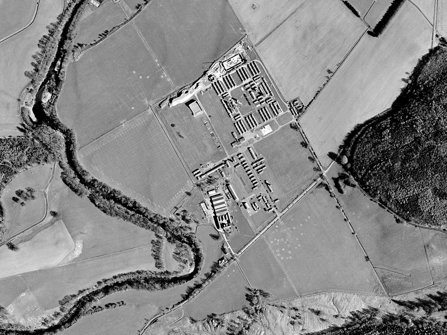
Excavation for a Regional Government Headquarters bunker at Cultybraggan Camp; Collection: Scottish Office APU, Sortie: ASS/60789, Frame: 0157 (26 April 1989)
Although the two sides never came to direct blows, each supported opposing sides in proxy wars such as the Korean War, the Vietnam War and the Soviet–Afghan War. Both sides employed extensive networks of spies alongside competing vigorously in fields like science and sport. The Cold War also led to a race for nuclear supremacy, with countries on both sides – but especially the USA and Soviet Union – building up large nuclear arsenals.
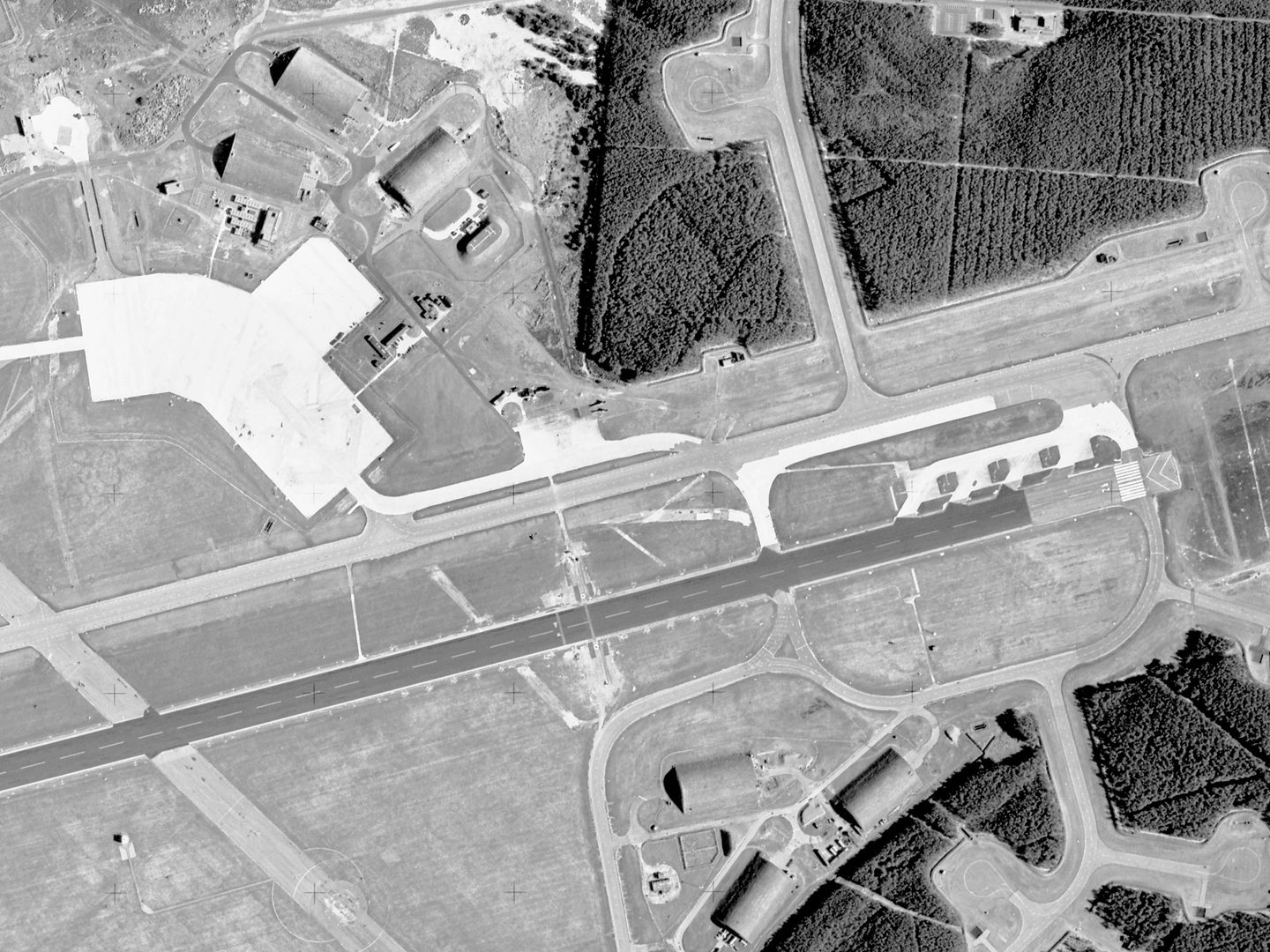
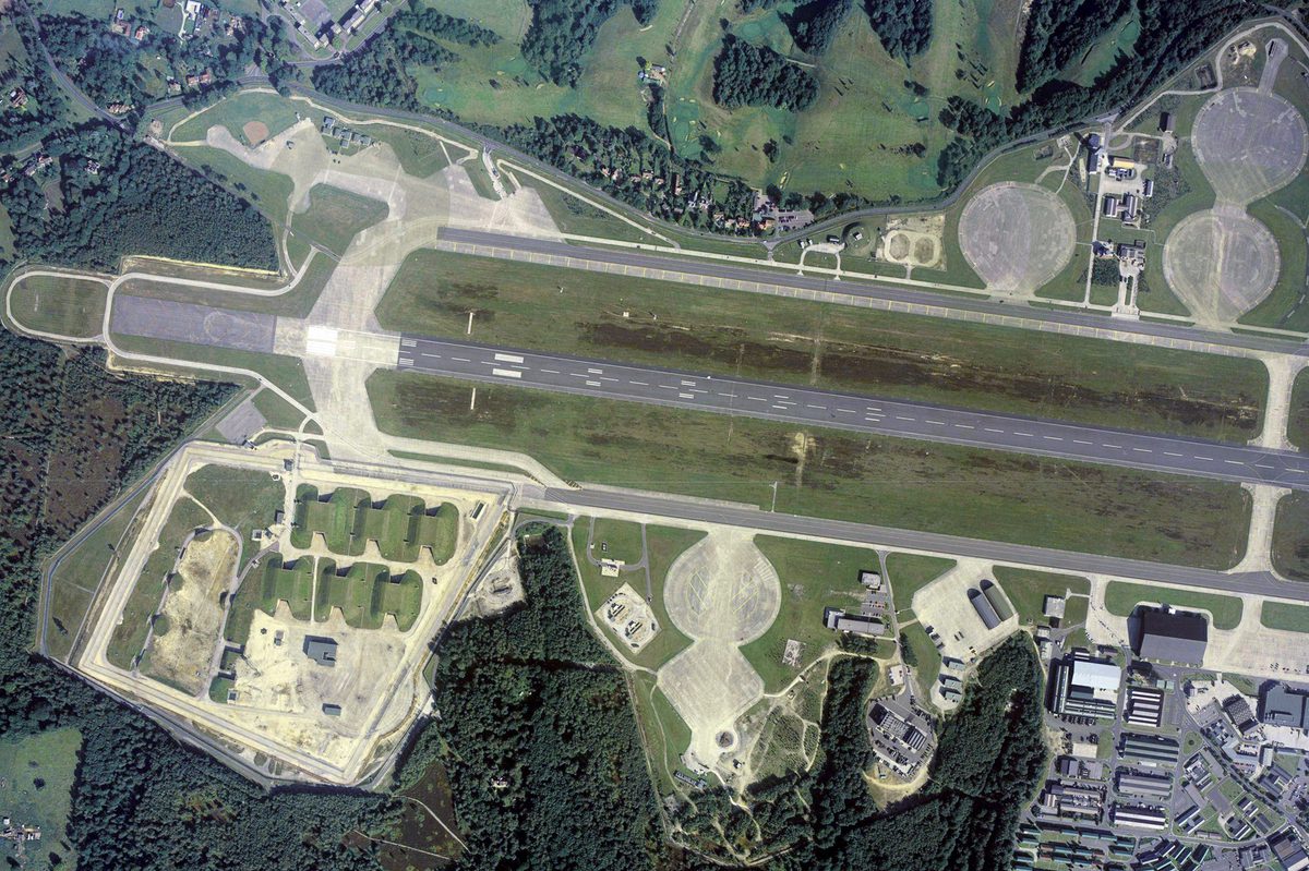
The Operational Readiness Platform at RAF Kinloss runway's east end, where 4 V-bombers would be parked, fuelled and armed; Collection: Scottish Office APU, Sortie: ASS/61589, Frame: 0073 (07 May 1989)
Nuclear Response
Until 1968, the UK’s nuclear deterrent was held by the Royal Air Force (RAF), which maintained a fleet of Valiant, Victor and Vulcan bombers (collectively known as V-bombers) at a state of constant readiness to deliver it. Several airfields in Europe and the Mediterranean were selected to serve in times of national emergency as dispersal sites for V-bombers armed with nuclear weapons.
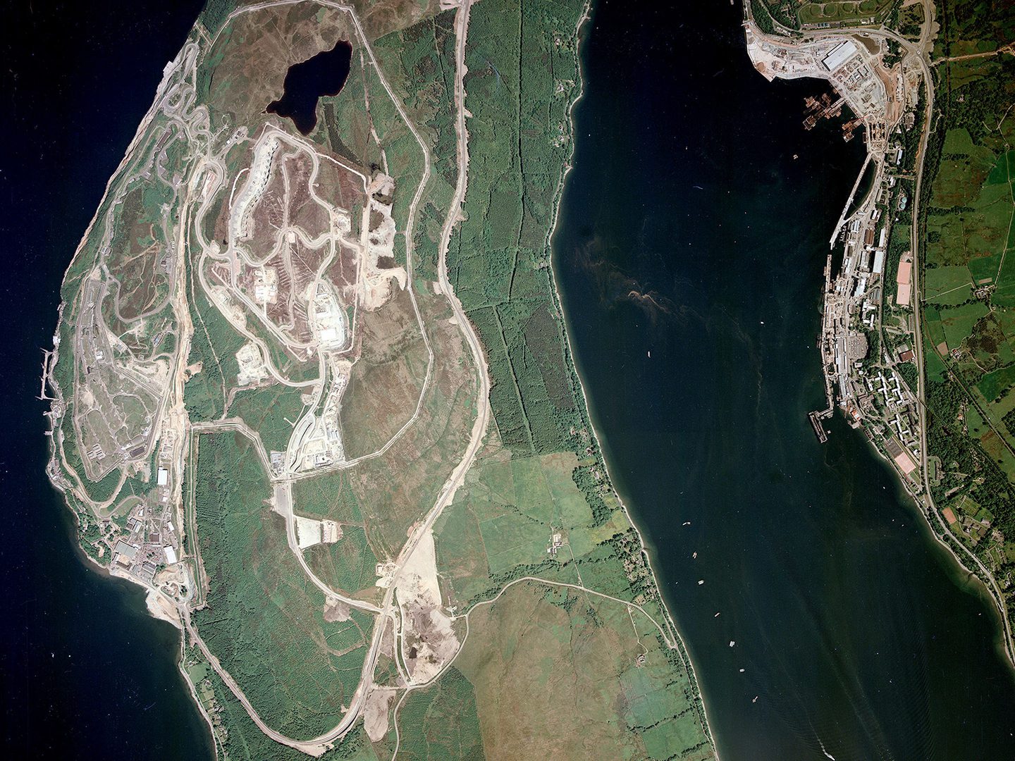
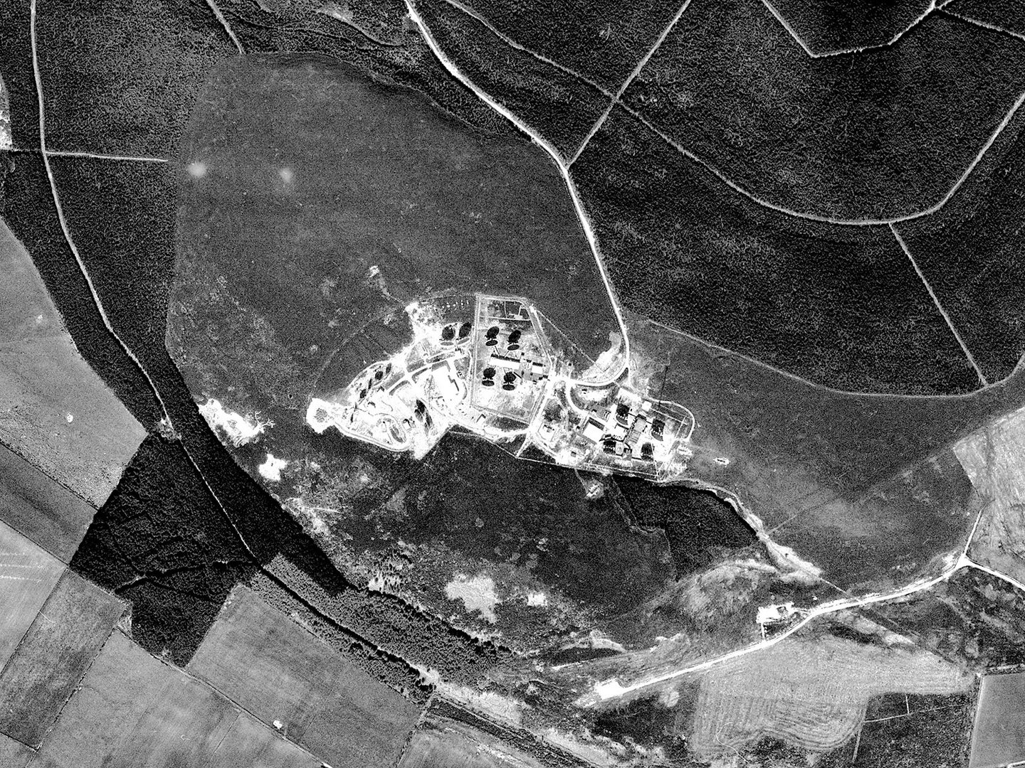
The Polaris nuclear warhead depot at RNAD Coulport (left) and Faslane nuclear submarine base (right); Collection: Scottish Office APU, Sortie: ASS/51488, Frame: 0038 (14 June 1988)
In 1968, the Royal Navy assumed responsibility for the UK’s nuclear deterrent when the nuclear-armed Polaris submarine-launched missile system was declared operational. Four Resolution-class ballistic missile submarines were built to maintain the deterrent. They operated out of HM Naval Base Clyde, at Faslane until their replacement in 1996. They were subsequently moved to Rosyth, Fife (alongside three nuclear-powered patrol submarines) for the complex process of decommissioning.
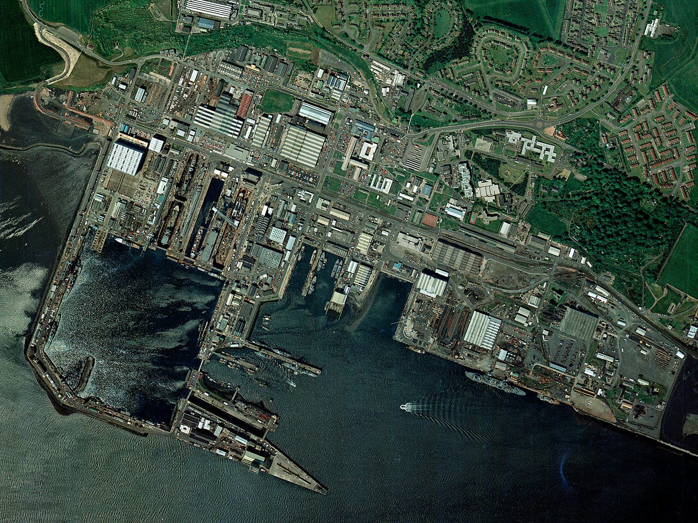
Rosyth Dockyard during its time as the sole location for refitting the Royal Navy's nuclear submarine fleet; Collection: Scottish Office APU, Sortie: ASS/51988, Frame: 0075 (07 June 1988)
Warning and Monitoring
During the Cold War, three Ballistic Missile Early Warning Stations (BMEWS) were built in the USA, Canada and the UK, to detect and track nuclear missiles launched from the east. To quickly pass this vital information to NATO commanders in the USA, a series of microwave communication relay stations were established between Britain and the USA.
The shadows of the 60-feet high microwave receiver and transmitter billboard antennae are visible at Mormond Hill; Collection: Scottish Office APU, Sortie: ASS/60788, Frame: 0171 (06 May 1988)
One of these stations was located at Mormond Hill, north Aberdeenshire. It was designed to receive and transmit microwave signals from the BMEWS site at RAF Fylingdales, Yorkshire, onward to commanders in the USA by the method of tropospheric scatter – sending radio waves over the horizon by 'bouncing' them off the tropospheric layer of the atmosphere.
The ‘elephant cage’ at RAF Edzell; Collection: Scottish Office APU, Sortie: ASS/51788, Frame: 0065 (18 June 1988)
At the other end of Aberdeenshire, RAF Edzell was the location of a US Navy high frequency direction finding (HF/DF) station. RAF Edzell was equipped with a large omnidirectional Wullenweber array – colloquially known as the 'elephant cage' – to identify the origins of radio signals. The station was used to detect and monitor faint radio transmissions originating in the North Atlantic and Eastern Europe.
Air Defence
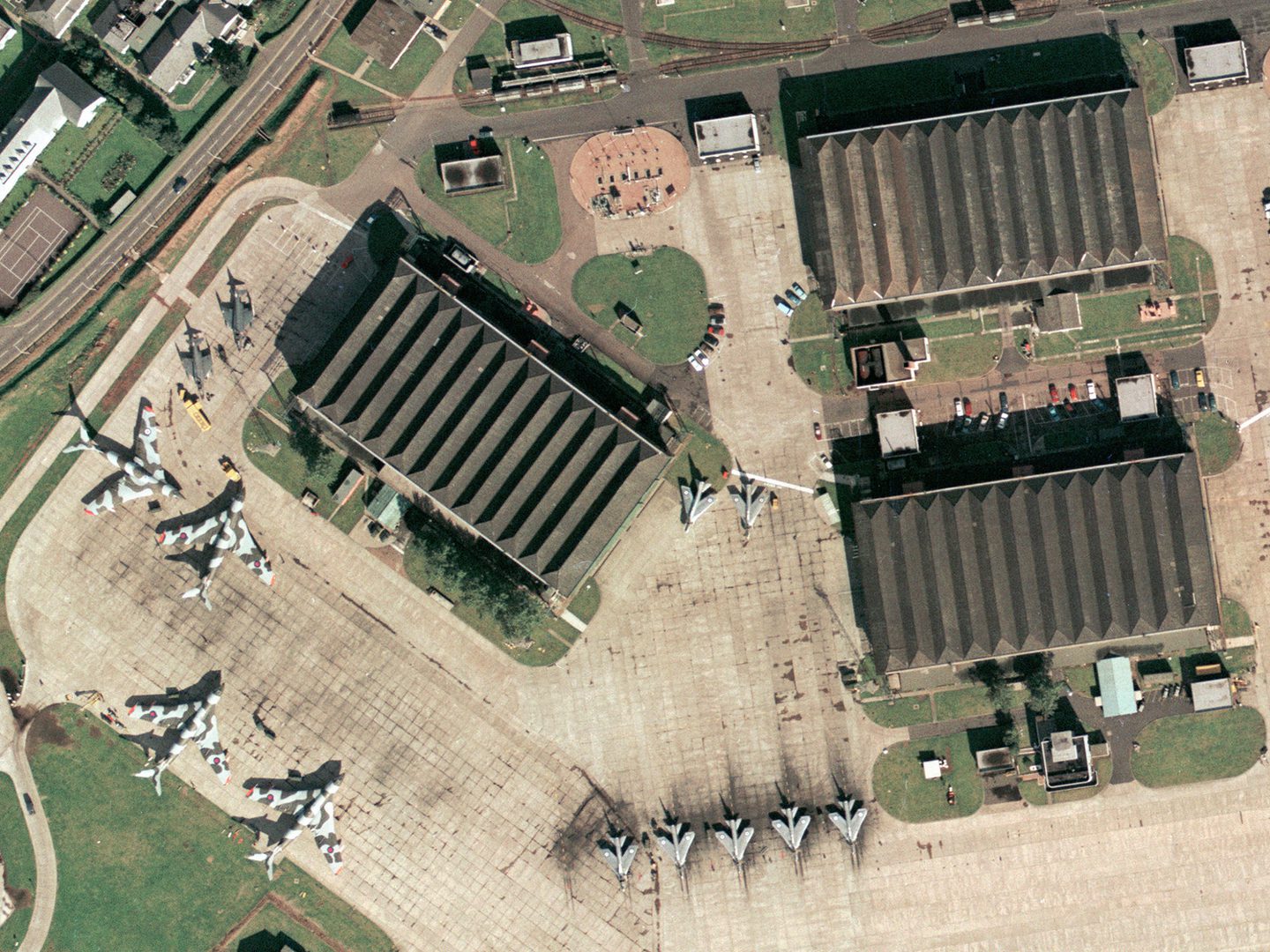
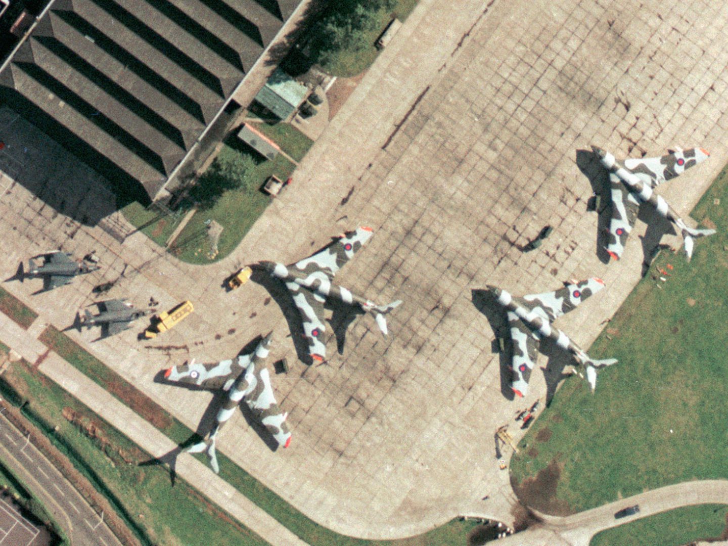
English Electric Lightning interceptor fighters and Handley Page Victor refuelling tankers at RAF Leuchars; Collection: Scottish Office APU, Sortie: FSL/7343/22, Frame: 0753 (14 September 1974)
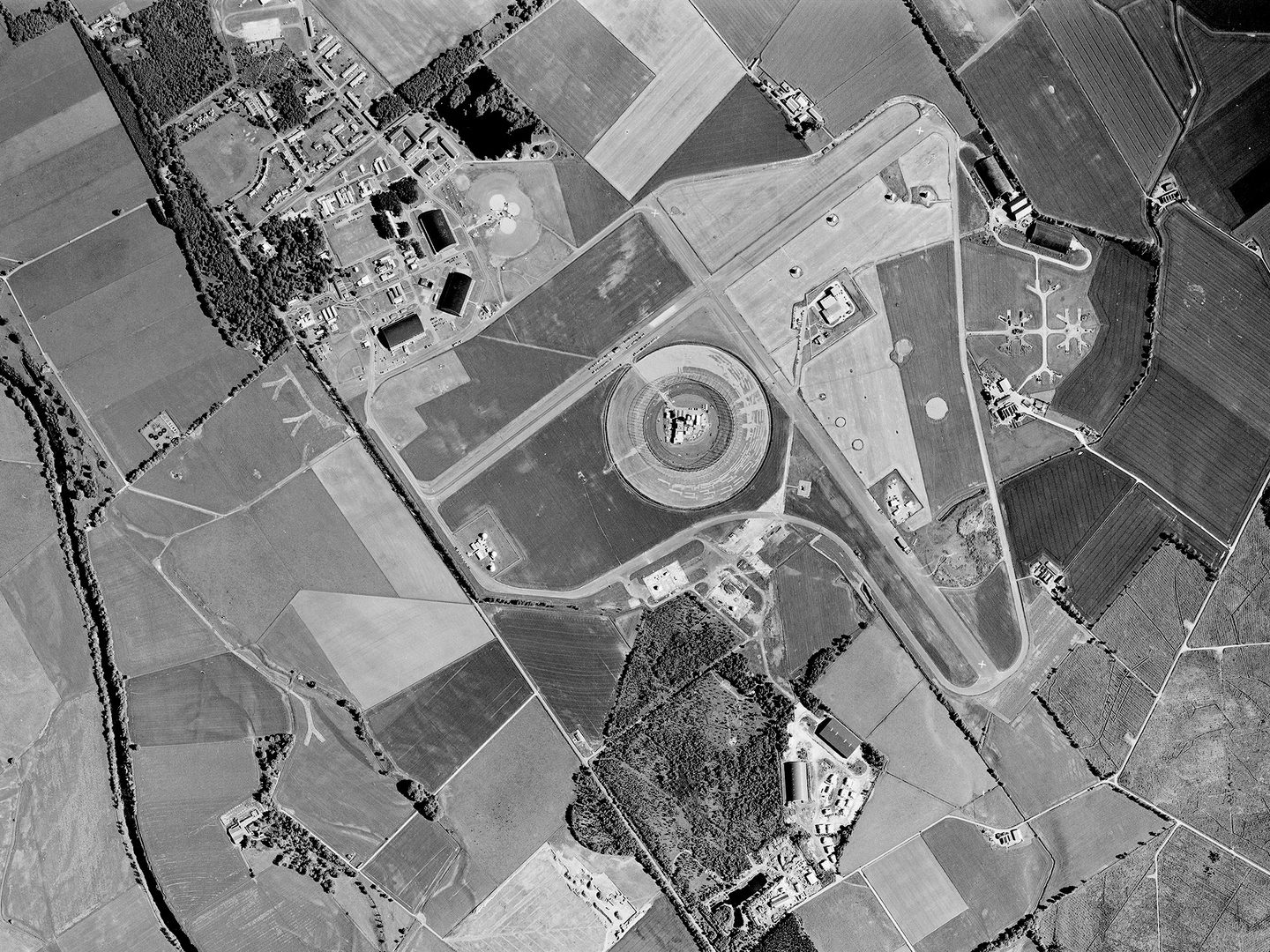
Until the capability moved to RAF Lossiemouth in 2014, fighter aircraft from RAF Leuchars were regularly scrambled to intercept Soviet (latterly Russian) reconnaissance aircraft and escort them away from UK airspace. At all times, two armed fighter jets were maintained on Quick Reaction Alert, housed in a purpose-built aircraft shed near the west end of the runway, ready to respond to any detected incursions.
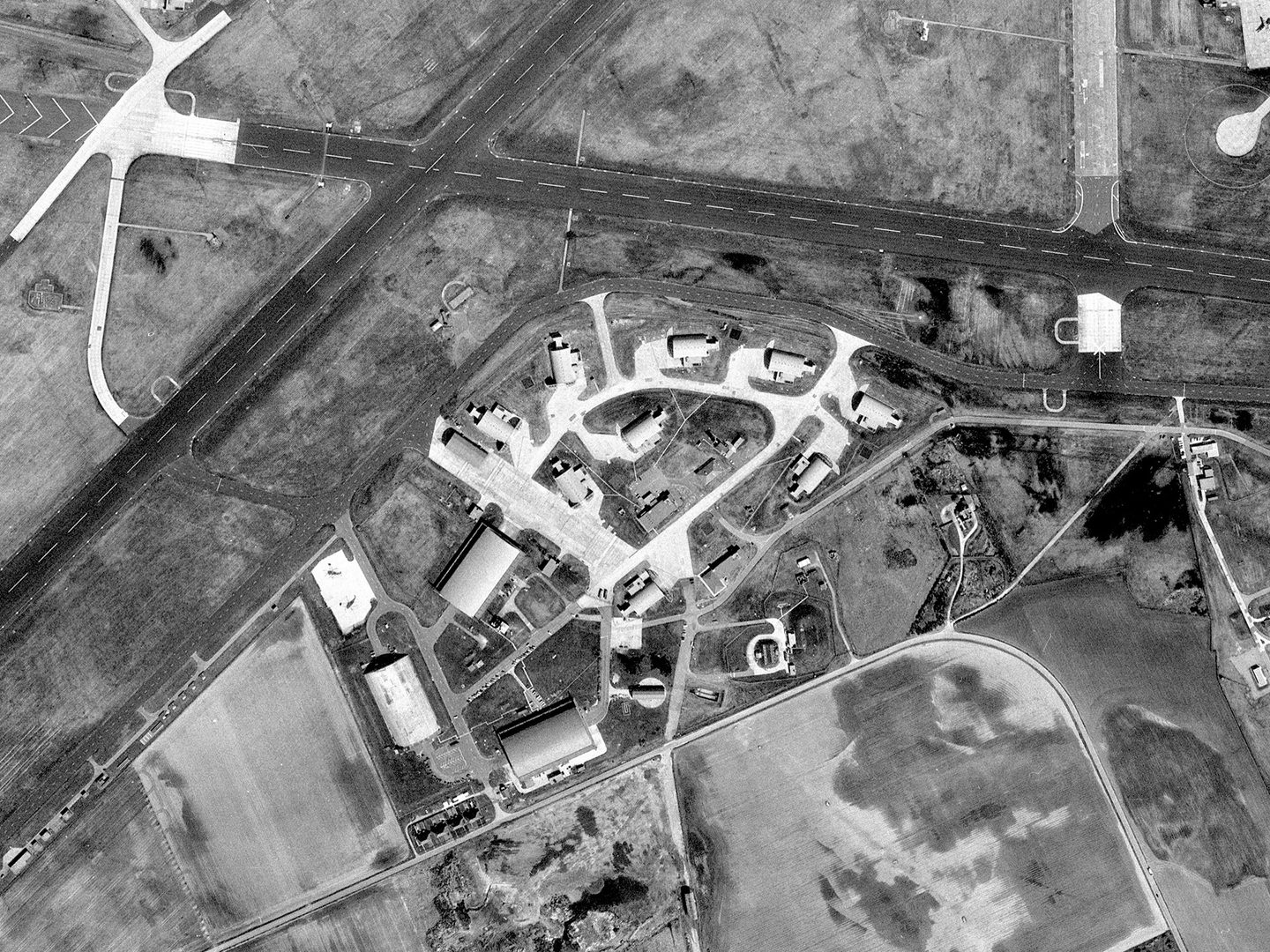
Hardened Aircraft Shelters at RAF Lossiemouth, built to house and protect combat aircraft from air attack; Collection: Scottish Office APU, Sortie: ASS/60788, Frame: 0005 (06 May 1988)
Protect and Survive
In the event of a nuclear attack being launched on Scotland, it would have been vital for the government to secure accurate and timely information. Royal Observer Corps (ROC) underground monitoring posts were constructed throughout the UK. Built to a standard pattern, these bunkers housed three observers who were trained to measure and report the power and location of nuclear detonations in their areas. Their observations were to be sent to a central control bunker, to enable staff to predict fallout patterns and provide warning to the civil population.

An ROC underground monitoring post, located in the enclosure south (left) of Duncansby Head lighthouse, John o' Groats; Collection: Scottish Office APU, Sortie: USN/214/206, Frame: 0108 (26 July 1963)
Fortunately, the Cold War came to an end in 1991 without the need for Scotland’s bunkers to be put to the test, but its mark remains on the country’s landscape. However, these reminders of global conflict risk disappearing or being forgotten. The National Collection of Aerial Photography is a valuable record of and insight into one of the most significant periods of world history.
Ben Reiss, NCAP Collections Manager
Discover the Cold War Scotland Exhibition at National Museums Scotland.
Explore the Cold War Network's Heritage Week.
Find out more about the topics and collections featured in this article:
Scottish Office APU Cold War Imagery Documents Global Political Events