Spotlight On: Rockall
Have you heard of Rockall? You wouldn’t be blamed for thinking this rock far off the Western coasts of Ireland and Scotland was just a rest stop for migrating birds.
However, it is in fact a heavily contested piece of land. As recently as 2012, the United Kingdom, Ireland, Denmark and Iceland all laid claim to this bit of rock peeping out from the surface of the North Atlantic. Just six years ago, in 2019, Ireland and the United Kingdom tussled over who has a right to fish in its waters.

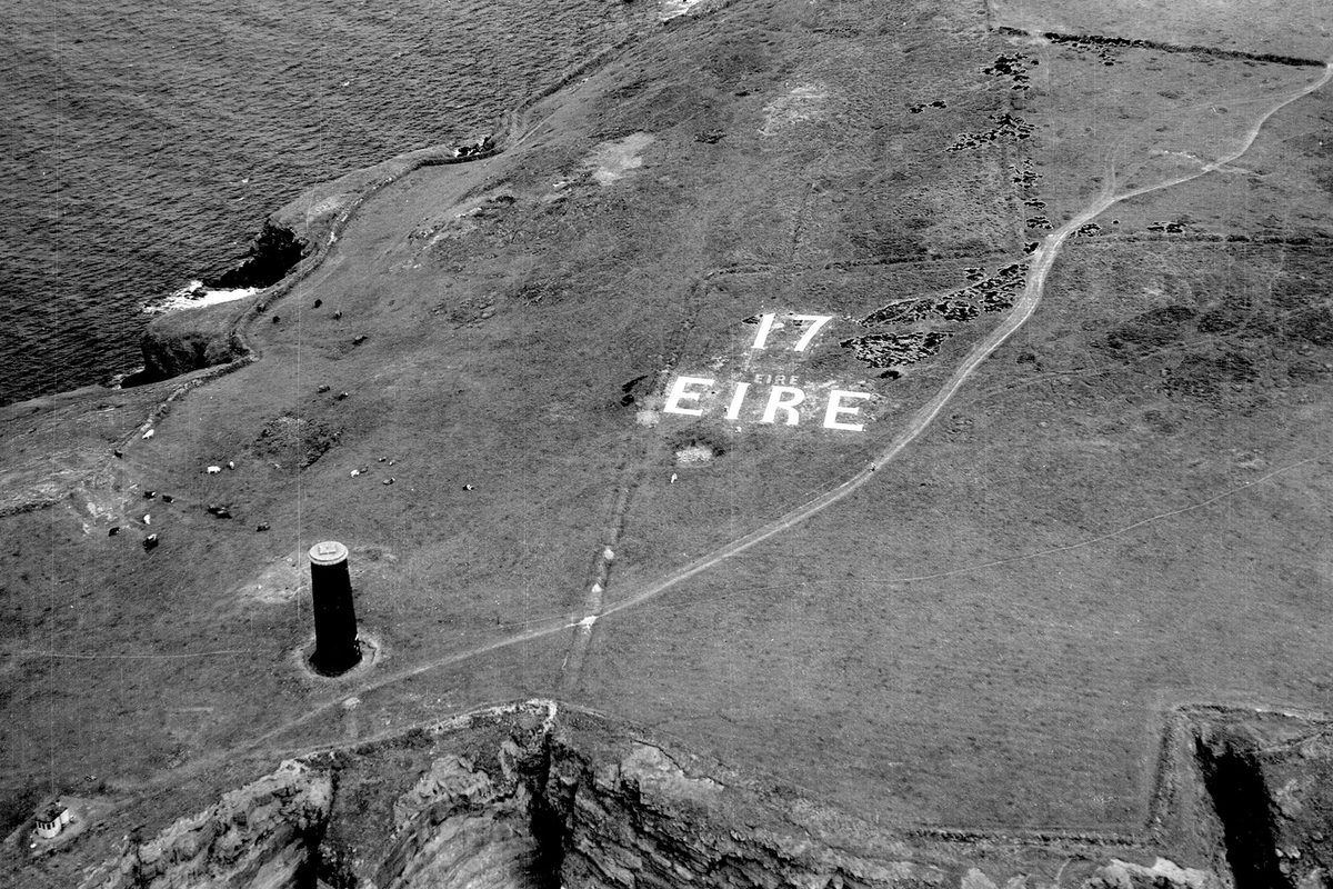
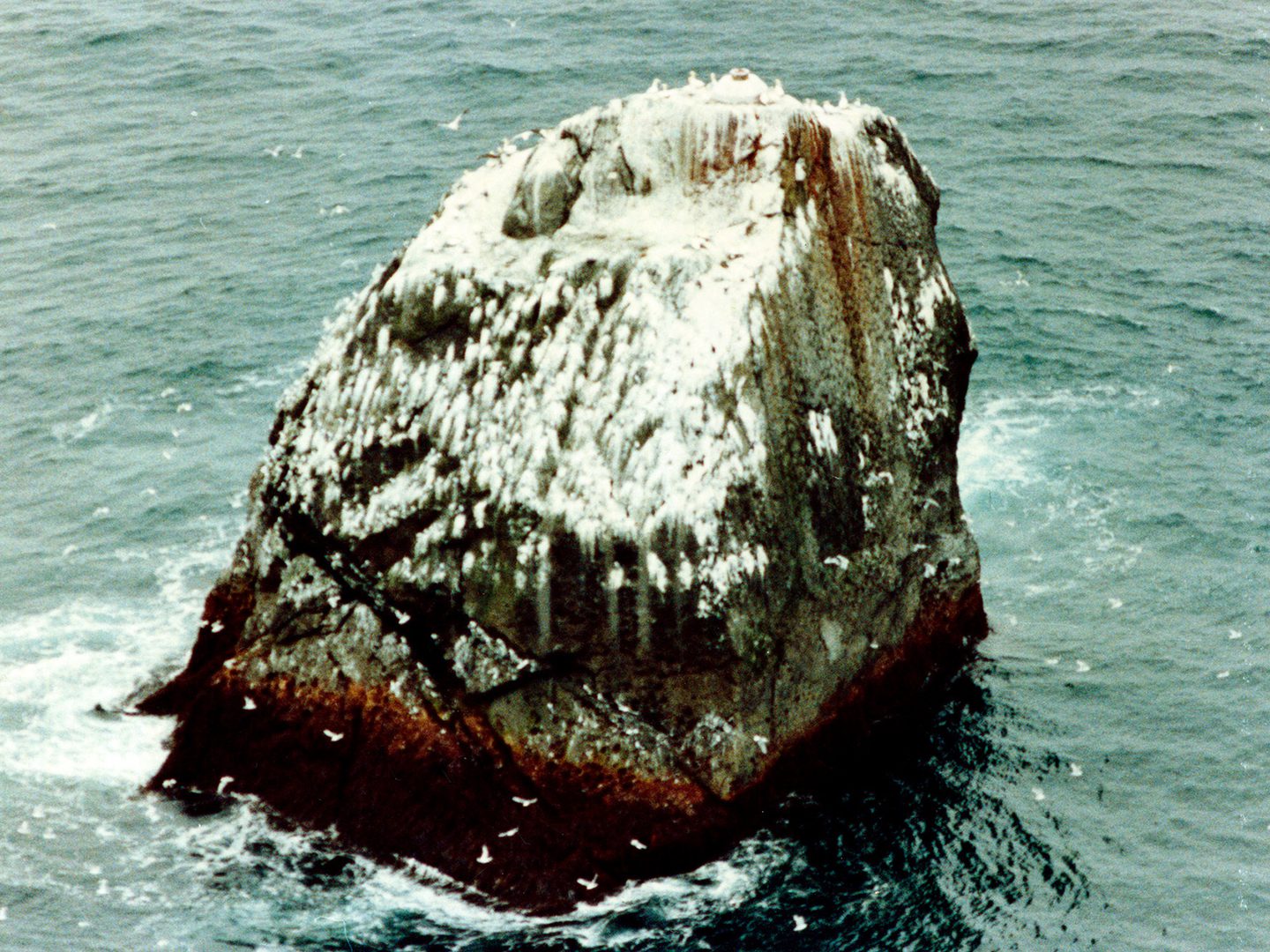
From this vantage point you can see the Union Flag painted on Rockall’s side, next to an orange navigational beacon; Collection: SCOT, Sortie: 120/RAF/2425, Frame: 0016 (13 May 1991)
But Why?
Rockall has appeared on maps since the sixteenth century, but was first landed on in 1811 as part of a Naval expedition led by Scottish naval officer Basil Hall. It is important to neighbouring Ireland and the UK for the excellent fishing in its surrounding waters.
In the twentieth century, Rockall’s appeal to the UK stemmed from anxiety about it creating an opening for the Soviet Union to spy on British rocket tests on South Uist. A small expedition went so far as to paint a Union Flag on the rock in 1955, laying claim to it and its surrounding waters. In 1972, the UK incorporated Rockall as a part of Scotland, attempting to further strengthen its claim on the rock.
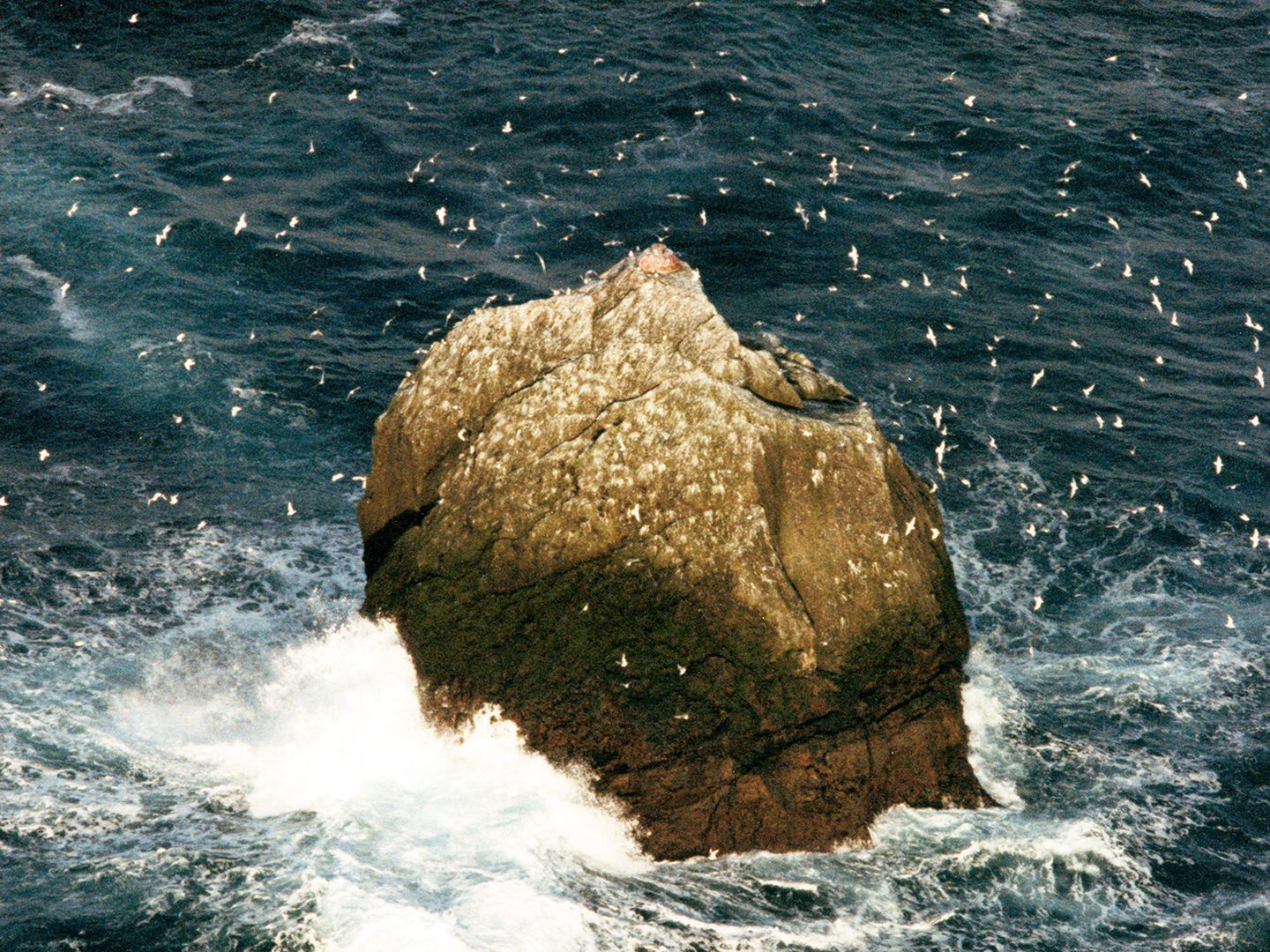
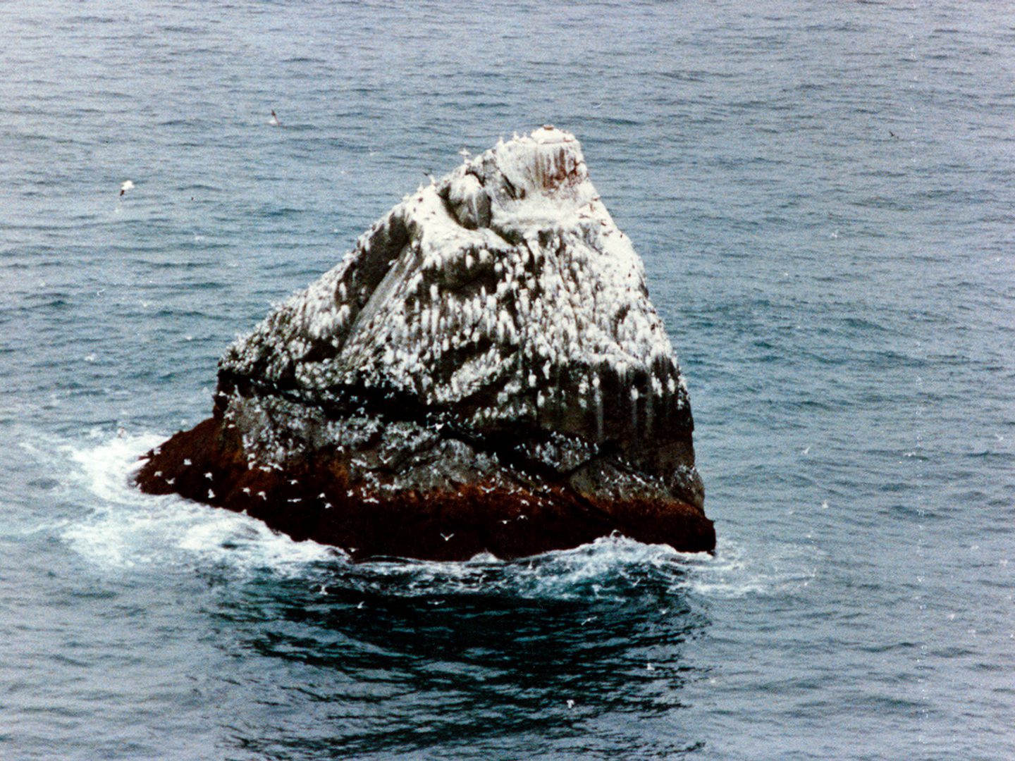
Over 20 species of seabird have been recorded on or near Rockall, including fulmars, gannets, kittiwakes, and guillemots; Collection: SCOT, Sortie: 120/RAF/2425, Frame: 0006 (13 May 1991)
Waveland
By the 1990s, it had become clear that Rockall was valuable because a successful claim upon it would open access to a vast tract of oil and natural gas in the surrounding seabed. Disputes around Rockall’s official economic designation and therefore claims to any associated resources are technically ongoing. Ireland views the nautical area around the rock as a shared territory, while the UK continues to assert it has sole control of the 12 surrounding nautical miles.
Struggles to claim the potential oil and gas resources caught the attention of Greenpeace and in 1997 they sent an expedition to claim the island as a micro-nation called Waveland.
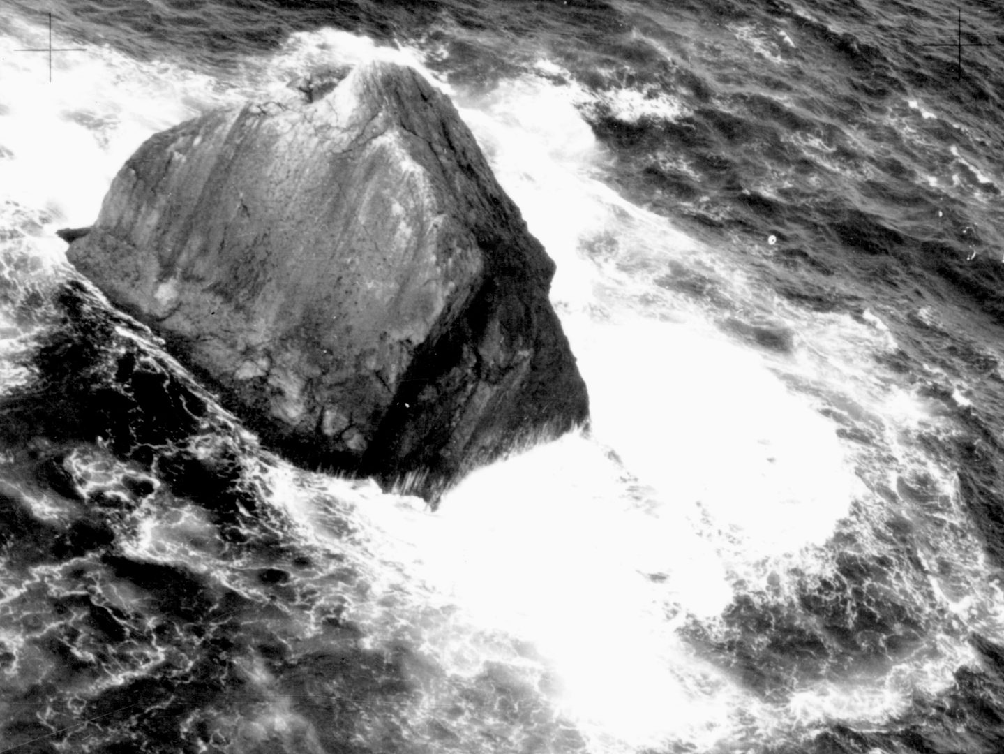
The site of Little Rockall, sibling of Rockall, which sits just beneath the surface of the water and poses a risk to passing ships; Collection: SCOT, Sortie: 201T/RAF/8258, Frame: 0004 (22 March 1991)
Where Aerial Photography Comes In
So why do we have so many photographs of Rockall? It’s hard to give an exact reason. However, because all the imagery of Rockall falls squarely within the Cold War period it is safe to say that it was taken at least in part as a piece of the UK’s efforts to protect its western sea border from Russian surveillance or attack.
This undated photograph of Rockall was likely taken with a handheld camera as part of a navigational exercise undertaken by the RAF; Collection: SCOT, Sortie: ROCKALL/0002, Frame: 0020 (undated)
It is worth noting that the images we have of Rockall are not a full photographic survey. Taken at different angles and without fully circling the rock, many of these images were likely taken as part of RAF navigation exercises rather than for mapping or reconnaissance. Maritime patrol crews would make the flight out to Rockall and circle it to get a few photographs as proof of their successful arrival before flying back to the mainland.
Here you can quite clearly that Rockall is in heavy use as a rest stop by migrating sea birds; Collection: SCOT, Sortie: ROCKALL/0001, Frame: 0004 (undated)
No matter the purpose of these images, they now serve as a fascinating reminder of the history of this unusual and highly contested rock. Who knows, maybe you’ll be next to visit…
Vivian Myron, NCAP Metadata Assistant
NCAP Imagery of Rockall Cold War Imagery Scottish Office Collection