VE Day and the Crucial Role of Photographic Reconnaissance and Intelligence
By the time Allied troops were advancing into Germany in early 1945, photographic reconnaissance had long been a central element of operational planning. Using specially modified variants of aircraft including the British Spitfire and the American P-38 Lightning, reconnaissance pilots flew deep into enemy territory – unarmed – to photograph enemy activity including transportation networks and industrial targets.
Aerial Photographic Reconnaissance
Flying high and fast, these aircraft could avoid most enemy interceptors and anti-aircraft fire while capturing high-definition images that were then rushed back to interpretation centres. There, teams of skilled Photographic Interpreters (PIs) pored over the photographs to extract vital intelligence. This information helped Allied commanders make operational decisions with great precision and confidence.
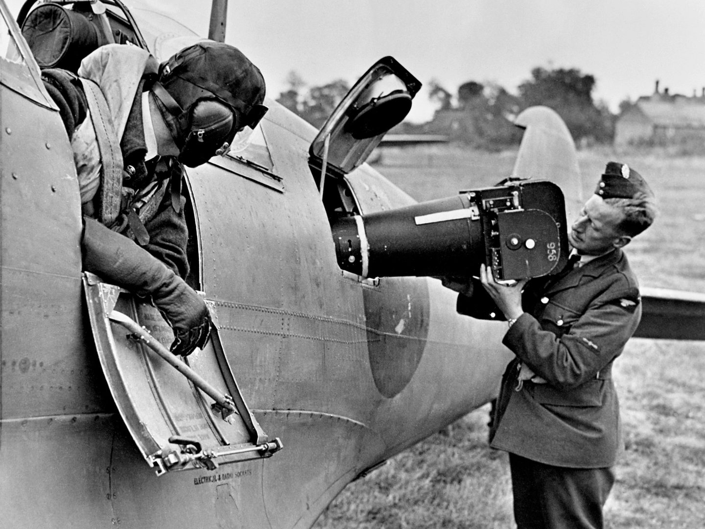
An aerial camera being loaded into a photo reconnaissance Spitfire; Image courtesy the Medmenham Collection
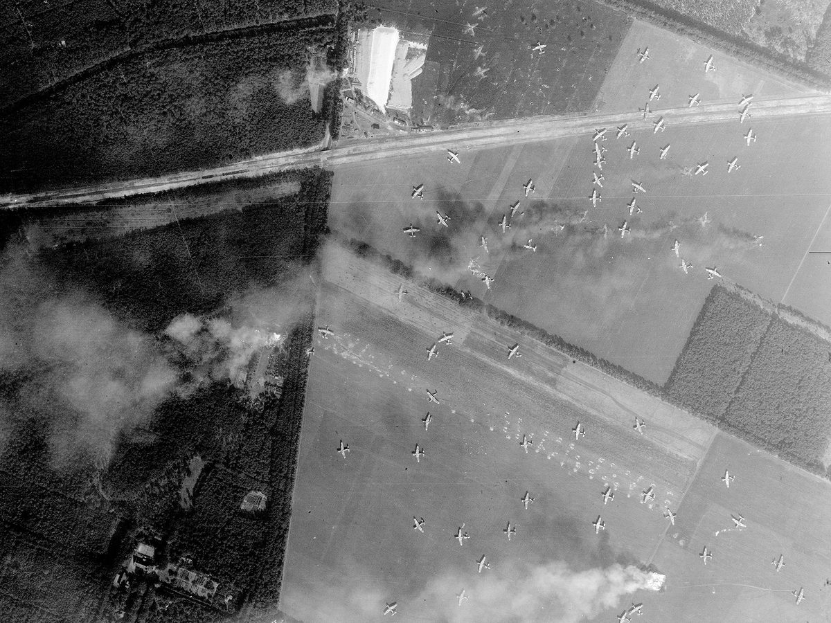
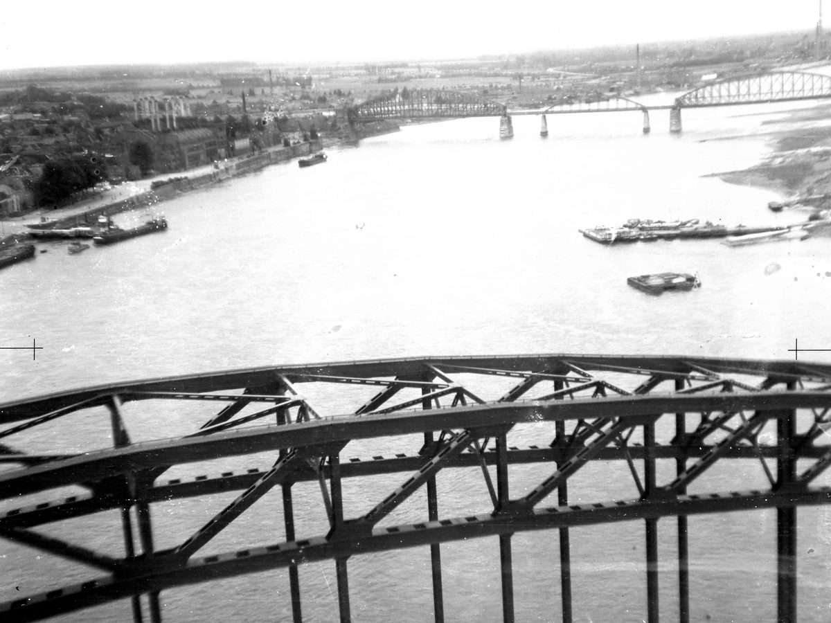
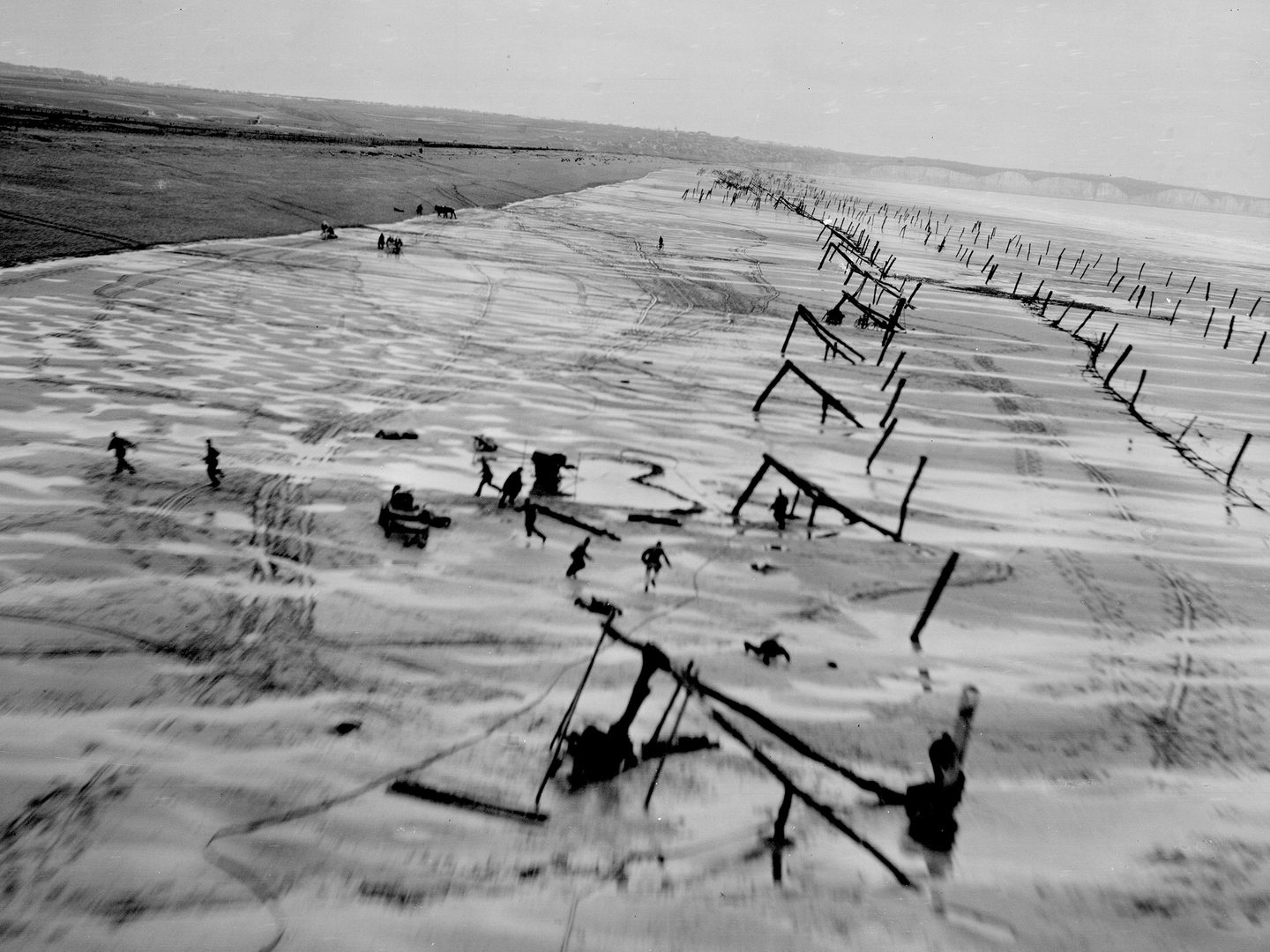
Aerial photography was used particularly heavily in the planning and execution of Operation OVERLORD. Regular sorties were flown not only to monitor the German army’s movements but also to check the effectiveness of air strikes on their defences before the landings. In the days leading up to D-Day, low-level reconnaissance flights over Normandy helped monitor German beach defences and assess the status of key infrastructure, such as bridges and roads that would be crucial for advancing Allied forces once the beaches were secured.
The Allied Central Interpretation Unit
By 1945, the scale of photographic reconnaissance and analysis had grown to unprecedented levels. The Allied Central Interpretation Unit (ACIU), located at RAF Medmenham, was a hub of intelligence processing, analysing millions of photographs. The American 325th Reconnaissance Wing, for example, flew daily missions and fed a constant stream of imagery into Allied interpretation centres.
These interpretation units weren’t just recruited from the military; they also employed experts from civilian backgrounds – geographers, architects, archaeologists, even artists – whose skills in observation and analysis proved invaluable in detecting camouflaged sites, changes in terrain, or the construction of new enemy positions.
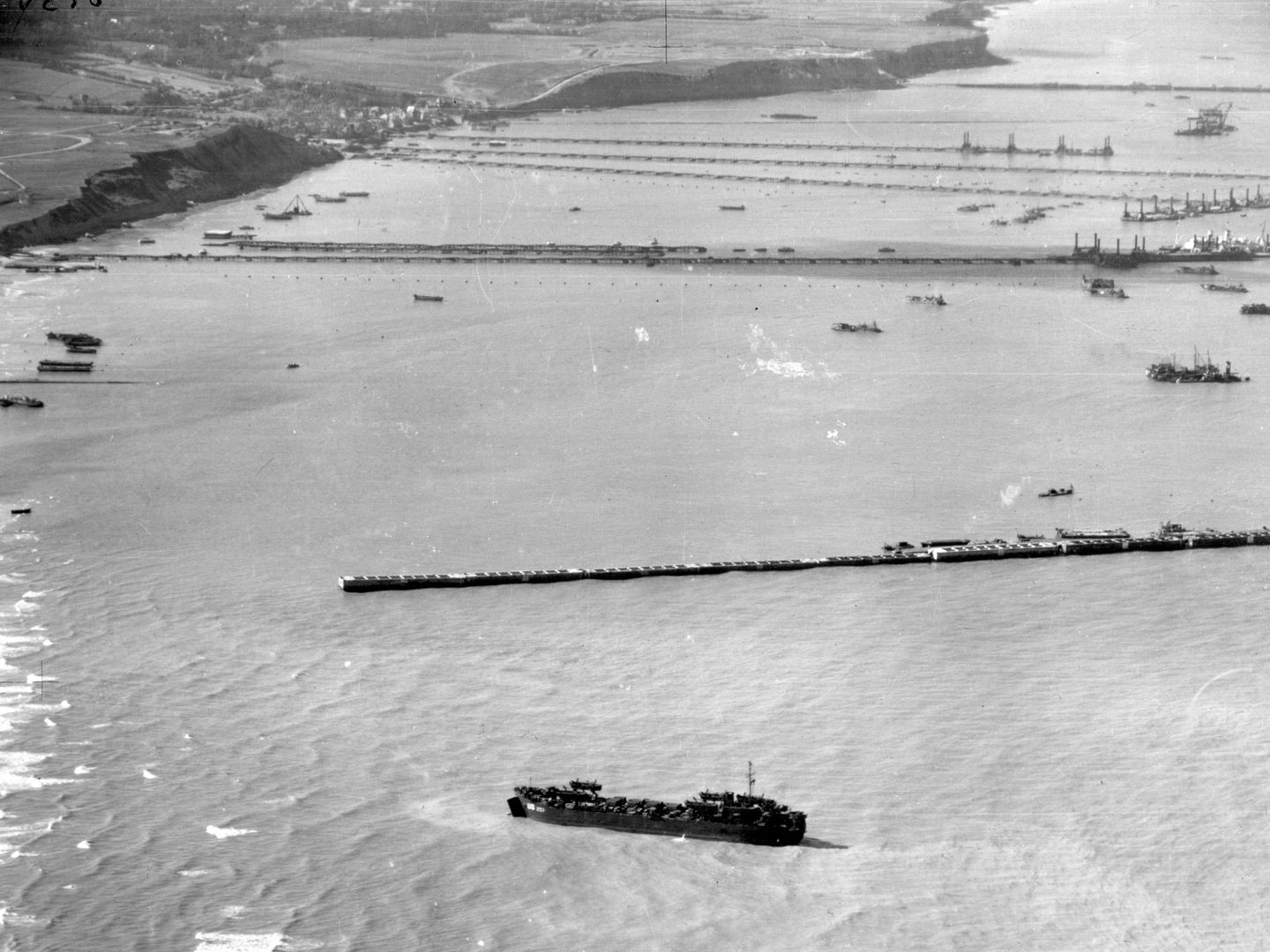
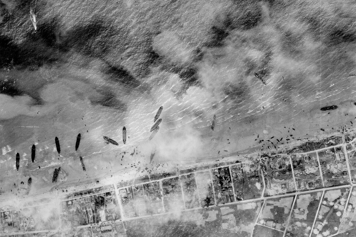
Keeping the Allied armies in Europe supplied until VE Day required complex solutions such as artificial harbours like Mulberry 'B'; Collection: JARIC, Sortie: 106G/3170, Frame: 0073 (02 October 1944)
Photographic intelligence gave the Allies a level of strategic insight that the Axis powers could not match. Allied leaders benefited from timely, visual information that allowed them to adapt quickly and strike accurately. Rather than relying on guesswork or outdated reports, thanks to intelligence based on up-to-date aerial reconnaissance, Allied planners could make informed decisions about where to attack, how to allocate resources, and when to act. In many cases, this reduced casualties and shortened engagements.
Victory in Europe
On May 8, 1945 – Victory in Europe Day – the headlines celebrated the bravery of infantrymen, the might of bombers, and the leadership of generals. Yet behind the scenes, the unarmed airmen who flew into enemy skies and the analysts who interpreted their photos were instrumental in making that victory possible.
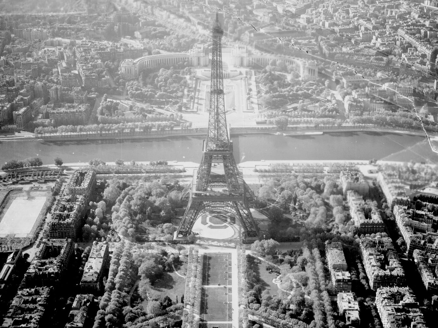
This dramatic image of the Eiffel Tower in Paris was captured barely three weeks before victory was declared in Europe; Collection: NARA, Sortie: US7/LOC/0001D/LIB, Frame: 0085 (19 April 1945)
Photographic reconnaissance and intelligence didn't just observe the war – they helped win it. In the months leading up to VE Day, they gave the Allies the clearest picture of the battlefield, guiding their final steps to triumph. The National Collection of Aerial Photography (NCAP) is home to millions of images that contributed to the Victory in Europe. Through care and conservation, we here at NCAP work to preserve this valuable legacy.
Justyne Snyder, NCAP Sales Admin Assistant