Project Perspective: Uncovering the Past with Historic Aerial Imagery Through Partnerships
Through a collaboration with Stockholm University and the University of California (Berkeley), and researchers at Stanford University and Caltech, the National Collection of Aerial Photography (NCAP) has been able to accelerate digitisation efforts and help transform access to historic aerial imagery and make it a more powerful tool for unlocking insights into land use and environmental change.
Finding Value in NCAP Collections
At NCAP, we are passionate about the potential of historic aerial imagery to transform how we understand the world. A recent feature article from Stockholm University, “Old Aerial Photos Provide a New Outlook on 20th Century History”, showcases the profound value of aerial photographs in research. The article and accompanying video highlight how our research partners are using these unique records to shed light on historic land use, urban development, and environmental change.
Building Relationships
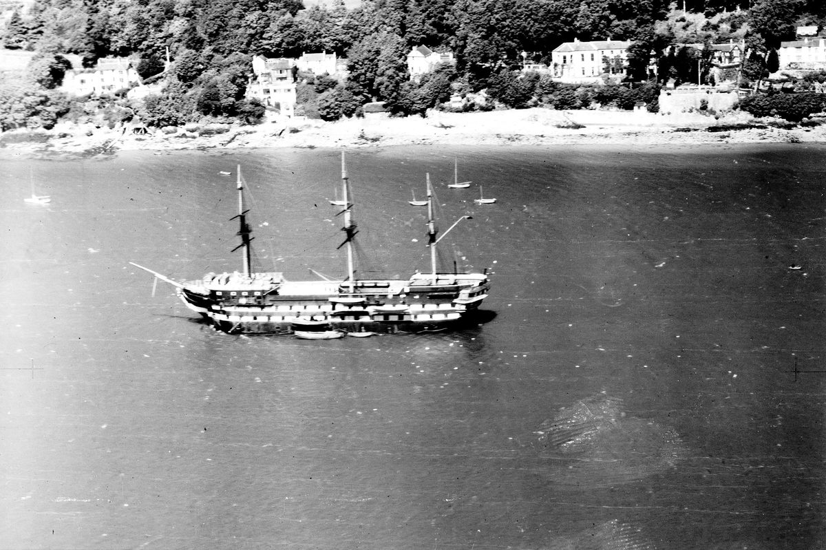
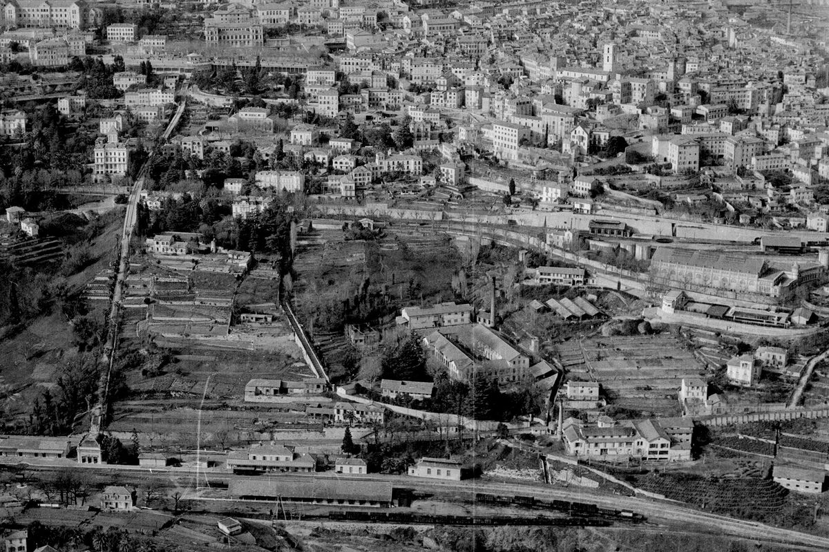
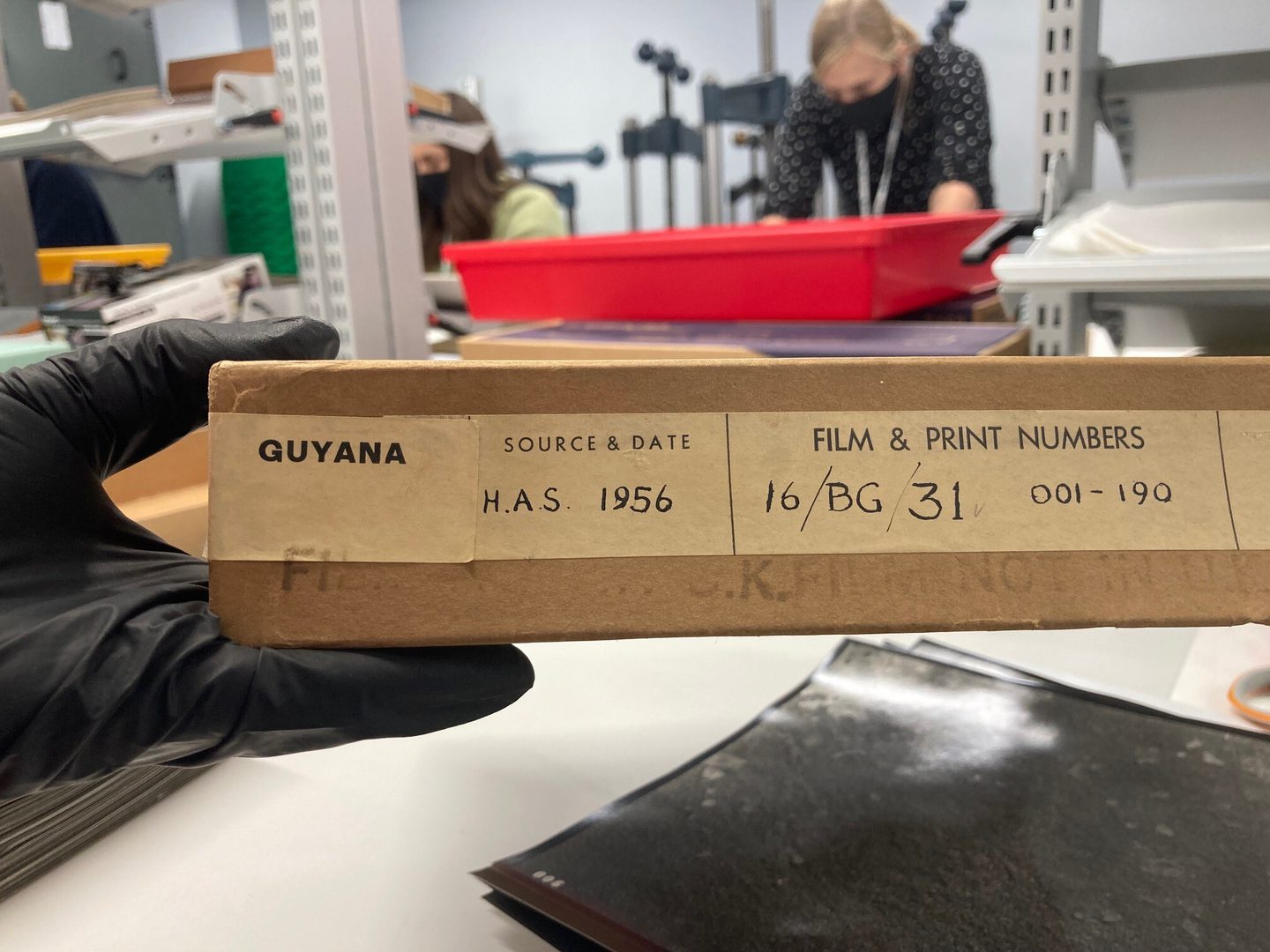
Through a collaboration with Stockholm University and the University of California (Berkeley), and researchers at Stanford University and Caltech, we worked on the digitisation of the Directorate of Overseas Surveys (DOS) Collection, a significant archive salvaged in 2012. The partnership exemplifies the innovative collaborations NCAP is fostering to enhance access to historic imagery. It has driven major advancements in how we preserve and digitise historic print collections, allowing us to expedite access to these invaluable records. The 1.7 million images in the DOS Collection (from over 30 million across NCAP’s total holdings) have already contributed to ground-breaking research across disciplines, underscoring the importance of collaboration in unlocking the full potential of aerial imagery.
Historic aerial imagery has long been a key resource in fields such as archaeology and history. At NCAP, we’re excited to build on these foundations by exploring new applications in the field of development economics. These photographs capture not only the physical world over decades, but also the human stories embedded within it—stories that researchers in diverse fields are beginning to unlock.

Anna Tompsett and Andreas Madestam from Stockholm University visit NCAP during the DOS digitisation project.
NCAP is also working to develop new partnerships to drive innovation and expand the accessibility of our collections. By collaborating with researchers and institutions worldwide, we aim to enhance the impact of our imagery and uncover even more ways it can contribute to academic and practical applications.
Watch the Video
We encourage you to watch the Stockholm University video and discover how aerial imagery is revolutionising 20th-century historical research. At NCAP, we are excited to support this growing community of researchers and to find even more ways these images can shape our understanding of the past—and the present.
Rachel Nordstrom, NCAP Operations Manager
To learn more about NCAP’s collections or potential partnerships, explore our website. Together, we can uncover new perspectives from above.
Learn more about DOS Learn more about our partners Visit Stockholm University