Operation Dynamo - Evacuating Dunkirk
In May 1940, 85 years ago this month, British and French troops moved north into Belgium to meet the invading German army. German tanks then advanced rapidly through northern France to the sea and split the Allied armies in two. The outflanked Allied troops held a shrinking perimeter around Dunkirk from 26 May to 4 June. During this time a fleet of naval and civilian vessels crossed the English Channel, evacuating troops to the south coast of England.
The Role of Aerial Photography
Photographs of Dunkirk from above (now in the National Collection of Aerial Photography - NCAP) showed the gradual slope of the seabed, which meant that large naval ships could not get close to the beach. The British Admiralty then sent out an appeal to boat owners in the south of England, asking for help with the evacuation. These smaller boats, crewed by civilians, were used to ferry troops from the shallow water near the beaches out to the waiting battleships. During the operation, the evacuating troops and their rescuers were under heavy fire from the German Air Force (Luftwaffe), heavy artillery and patrolling U-boats and E-boats.
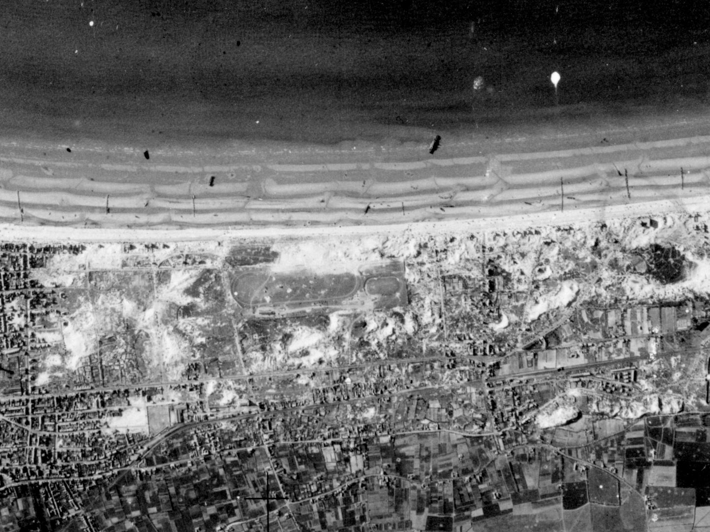
Abandoned vehicles and sunken ships litter the evacuation beach east of Dunkirk; Collection: ACIU, Sortie: HNA/0033, Frame: 0227 (05 June 1940)
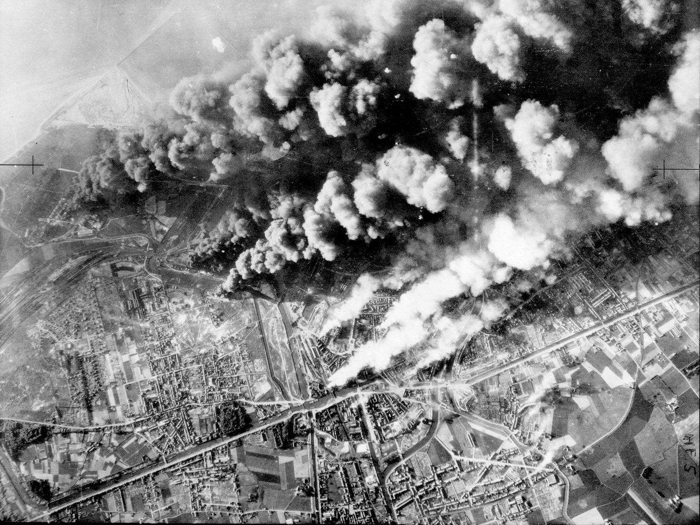
The conditions for the evacuation were considered miraculous, because of the unusually calm weather that enabled small boats to approach the beach, as well as the westerly direction of the wind which blew smoke across the beaches and obscured the German view of the evacuating troops. Some of the aerial photographs from 26-29 May 1940 show huge clouds of smoke from the damaged Saint Pol oil refinery, filling the sky above the beaches.
Thick clouds of smoke from burning oil tanks obscure the harbour and beaches below; Collection: ACIU, Sortie: HNA/0024, Frame: 0023 (27 May 1940)
However, on 29 May the wind changed direction, blowing the smoke away and exposing the beaches to the Luftwaffe. The air attacks that followed were so severe that the evacuation could only continue during the night. The Royal Air Force (RAF) did not have the numbers to provide continuous air cover and suffered heavy losses of both planes and lives. From the aerial photographs, we can see that some pilots had to make forced landings after their planes were hit by enemy fire.
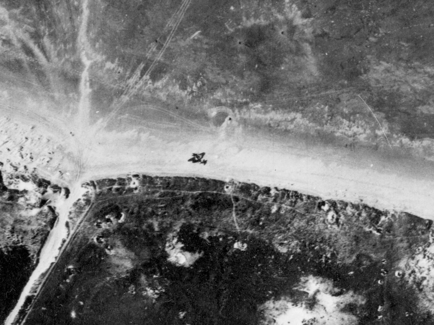
A damaged aircraft crash-landed on the beach at Dunkirk; Collection: ACIU, Sortie: HAA/0034, Frame: 0207 (02 June 1940)
Interpreting the Images
As well as showing the progress of the evacuation, aerial photographs of the advancing German forces revealed key targets to photographic interpreters, which could be bombed in order to slow the invasion and buy more time for the evacuating troops. The RAF specifically targeted railway lines to delay the supplies being sent to the German front lines. Another delaying tactic was intentionally flooding areas of land to make them less accessible, as seen in the aerial photographs from 27 May 1940.

Flooded fields between Bergues and Dunkirk; Collection: ACIU, Sortie: HNA/0024, Frame: 0222 (27 May 1940)
The evacuation ended on 4th June, leaving about 90,000 troops behind to be taken prisoner. Despite the Allies being pushed out of Europe and losing vital equipment, the evacuation from Dunkirk enabled the British to continue the war, with the core of its army still intact.
Mairi Westlake, NCAP Collections Assistant