Photographic Reconnaissance and the Maritime War
Shipping Intelligence and the Maritime War
Shipping intelligence was a cornerstone of Allied success during the Second World War. Control of the seas determined the movement of troops, fuel, food and raw materials, making merchant shipping and naval forces prime intelligence targets. For the Allies, understanding where enemy ships were built, repaired, assembled and deployed was essential to both offensive and defensive strategy.
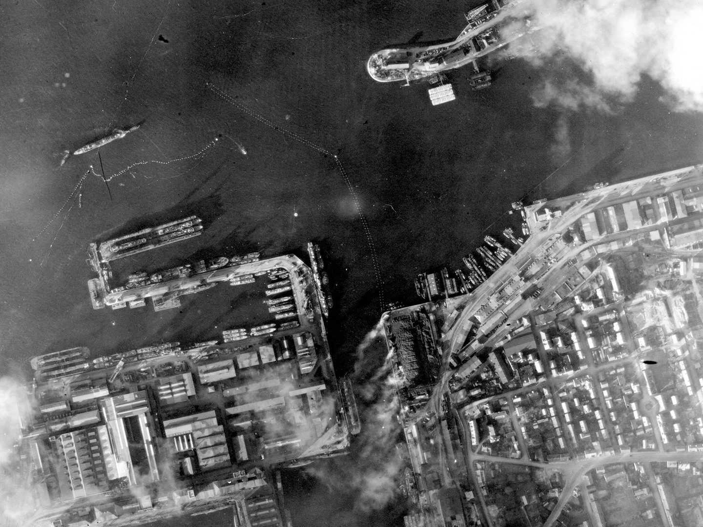
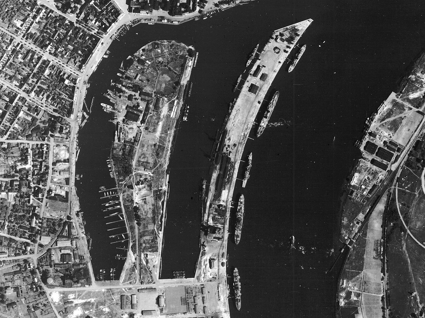
The German port of Kiel, a major naval base, shipbuilding centre and production site for submarines; Collection: ACIU, Sortie: N/0712, Frame: 5026 (24 January 1943)
The maritime war extended far beyond open ocean battles. Ports, shipyards, anchorages and coastal routes formed a complex network that sustained the Axis war effort. Intelligence on shipping activity allowed Allied planners to assess naval strength, anticipate fleet movements and disrupt supply chains. By identifying concentrations of merchant vessels or warships, commanders could prioritise targets that would have the greatest strategic and economic impact.
Aerial Photographic Reconnaissance as a Tool for Shipping Intelligence
Aerial photo reconnaissance became one of the most effective means of gathering shipping intelligence. High-altitude and low-level photographic missions provided detailed images of harbours, dry docks, submarine pens and coastal waters. From these images, analysts could identify individual ships, estimate tonnage and determine vessel types ranging from battleships and cruisers to tankers and cargo vessels.
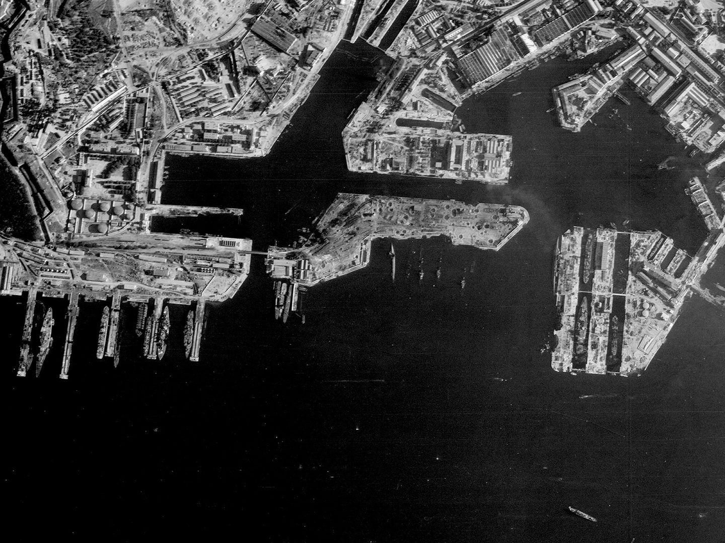
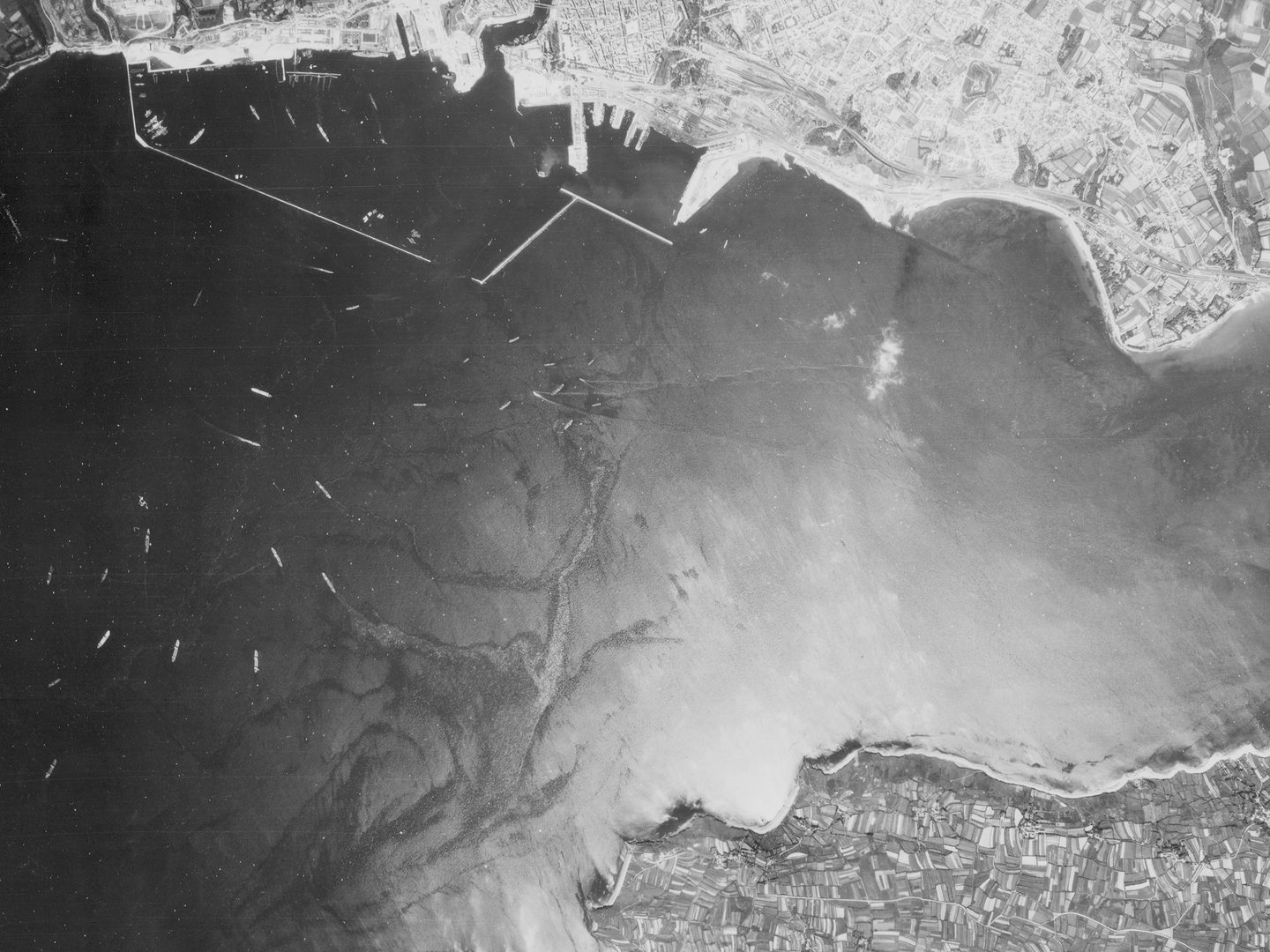
The French port of Toulon, with the sunken ships of the French fleet - scuttled by Vichy France in November 1942 - still visible; Collection: NARA, Sortie: 23SF/0577, Frame: 4103 (19 June 1944)
Regular photographic coverage allowed intelligence units to track change over time. A ship present one day and gone the next might indicate an imminent operation or redeployment. Damage assessments following air raids revealed which vessels remained operational and which were out of action. Even minor details, such as the position of cranes, the presence of camouflage nets or oil slicks in harbour waters, could offer clues to shipping activity.
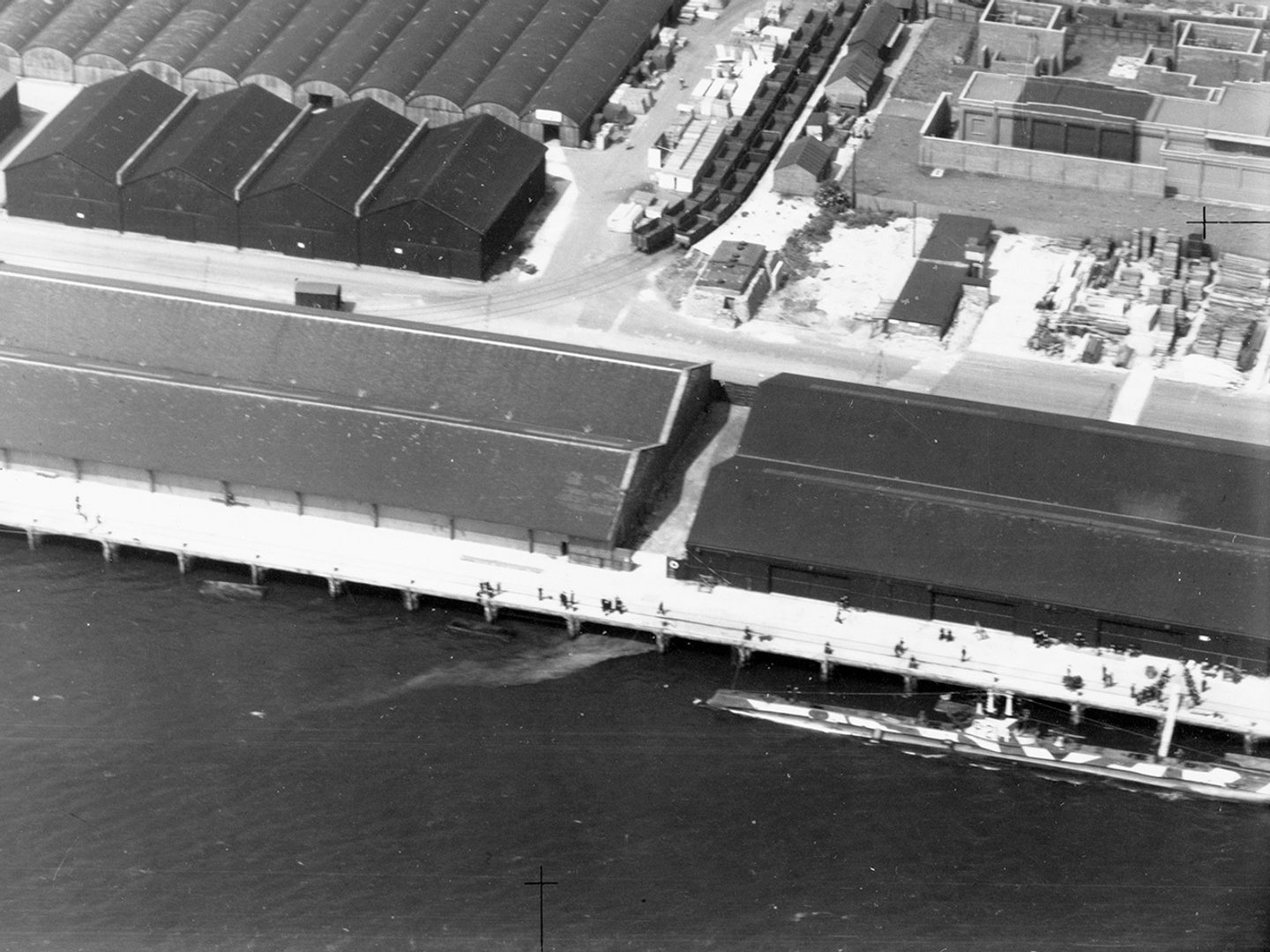
Allied submarines like the one seen in this image conducted intelligence patrols of the North Sea from their base at Dundee; Collection: SCOT, Sortie: M/040/NLA/066, Frame: 0023 (02 July 1943)
Key ports across occupied Europe and the Mediterranean were repeatedly photographed, including Brest, Hamburg, Genoa and Piraeus. These images were cross-referenced with naval intelligence, signals intelligence and convoy reports to build a comprehensive picture of Axis maritime capability. Shipping intelligence derived from aerial photography was instrumental in directing naval patrols, planning bombing campaigns and supporting convoy protection in contested waters.
Analysis, Operations and Lasting Significance
The effectiveness of shipping intelligence depended on skilled interpretation. Photographic Interpreters (PIs) working in the Allied Central Interpretation Unit at RAF Medmenham, were trained to recognise ship silhouettes, measure hull dimensions and identify construction stages in shipyards. Their assessments informed high-level strategic decisions, such as when to attack ports, which shipyards to prioritise and how to allocate precious naval and air resources.
The occupied Polish port of Świnoujście, known as Swinemünde in German; Collection: JARIC, Sortie: N/0756, Frame: 1075 (01 March 1943)
Shipping intelligence played a vital role in major campaigns, including the Battle of the Atlantic, the Mediterranean convoys and preparations for amphibious landings. By reducing the ability of the Axis powers to move supplies and reinforce distant fronts, Allied forces steadily gained the upper hand at sea.
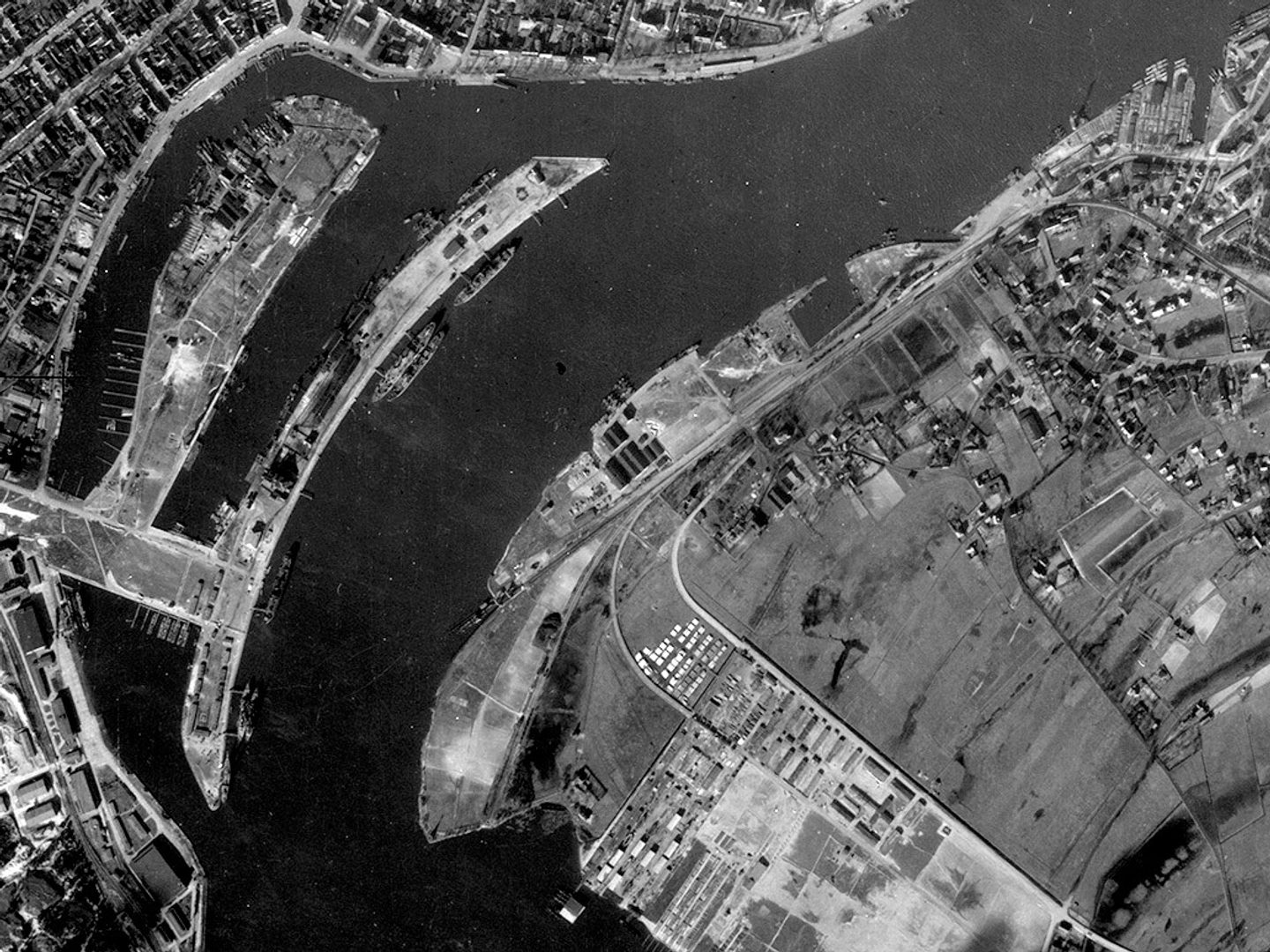
The Germans also relied on aerial photography - like this image of the French port of Brest before occupation - for naval intelligence; Collection: NARA, Sortie: TUGX/2269, Frame: 0122 (03 June 1940)
Today, the surviving aerial photographs held by NCAP provide a remarkable record of wartime shipping intelligence. They reveal not only the scale of the maritime conflict but also the analytical skill that transformed aerial images into decisive strategic advantage. These photographs remain an invaluable resource for understanding how intelligence shaped the outcome of the Second World War.
Isabella Taylor, NCAP Metadata Assistant