A History of Star Forts: The Rise of a Revolutionary Military Architecture
The Star Fort
Few military structures are as distinctive when viewed from above as star forts. Their striking geometric outlines, characterised by angular walls and projecting bastions, can still be recognised across landscapes throughout Europe and beyond.
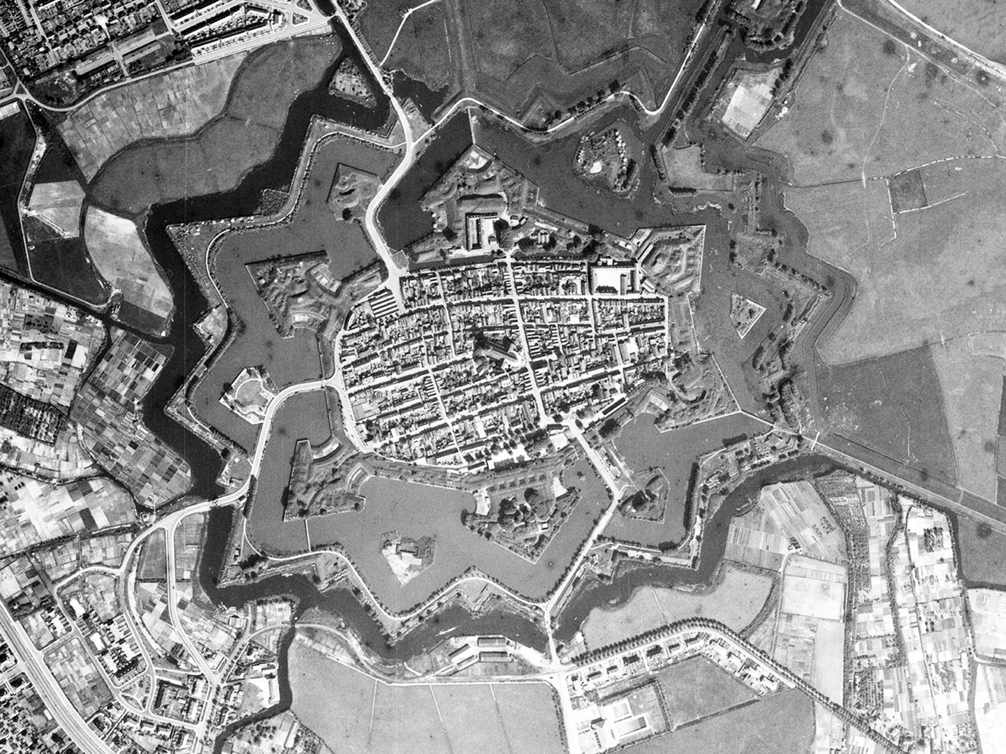
The 17th-century star-shaped fortifications of the city of Naarden in the Netherlands are clearly visible from the air; Collection: NARA, Sortie: US7/1660, Frame: 4043 (30 May 1944)
Originally designed to withstand the growing power of artillery, these remarkable fortifications offer a fascinating insight into the changing nature of warfare, military engineering and historic landscapes that survive today. Through aerial photography, their complex designs and relationships with the surrounding landscape can be explored from an entirely different perspective.
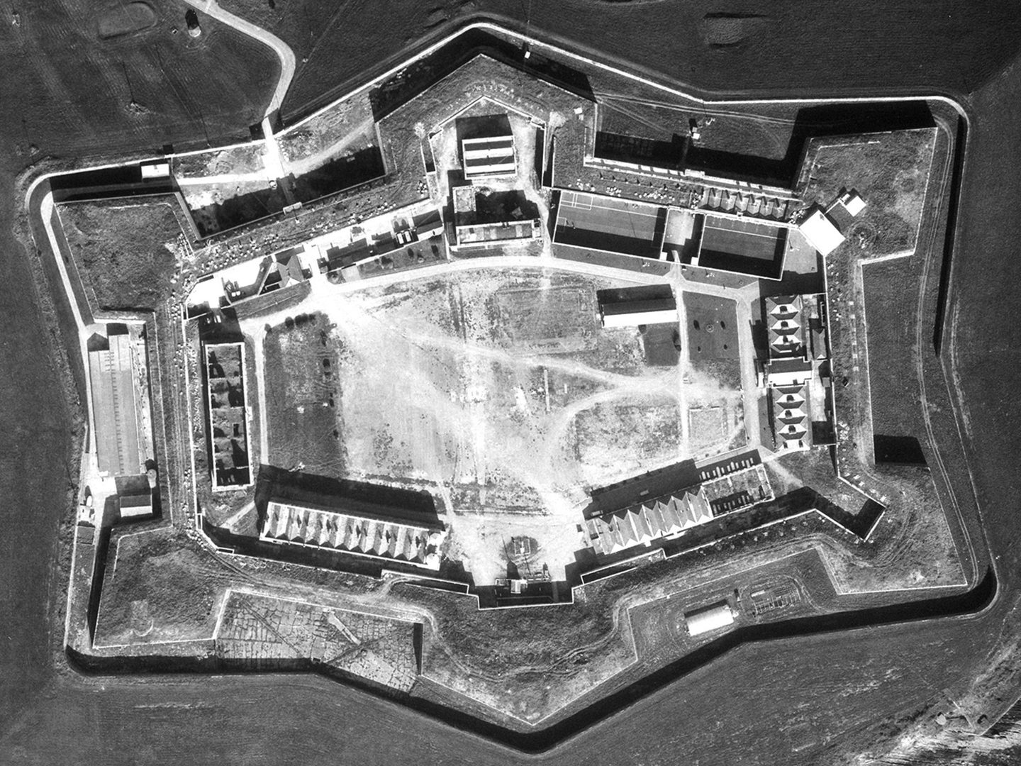
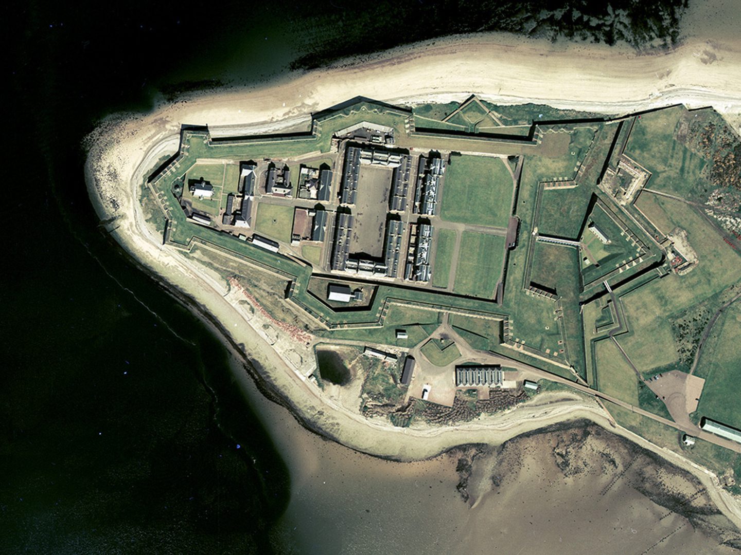
Fort Mitchel was built by British forces on Spike Island to defend the approaches to Cork Harbour; Collection: Irish Military Archives, Sortie: AP/PR0026A, Frame: 0064 (undated)
The Origins of the Star Fort
The development of star forts can be traced to Renaissance Italy during the late fifteenth and early sixteenth centuries. Advances in gunpowder technology and artillery had fundamentally changed the nature of warfare, making traditional medieval castles increasingly vulnerable to canon fire. Their tall, relatively thin stones walls, once effective against earlier siege weapons, could now be breached by increasingly powerful artillery.
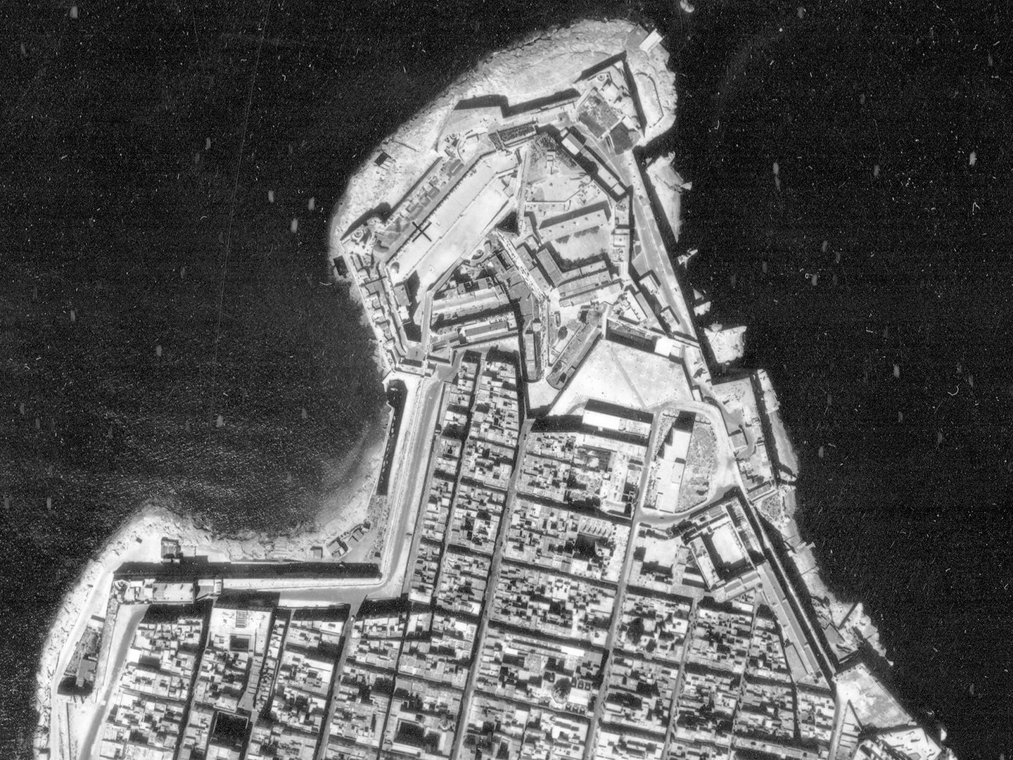
Fort Saint Elmo in Valletta, Malta is comprised of a 16th-century central section surrounded by later walls and bastions; Collection: DOS, Sortie: 31/MT/0002, Frame: 0111 (17 August 1957)
In response, military engineers began developing new defensive systems designed to withstand bombardment. Known as trace italienne, or Italian outline, these fortifications introduced lower, thicker walls, often reinforced with earth, alongside projecting angular bastions. This created the distinctive star-shaped ground plans that give these structures their name.
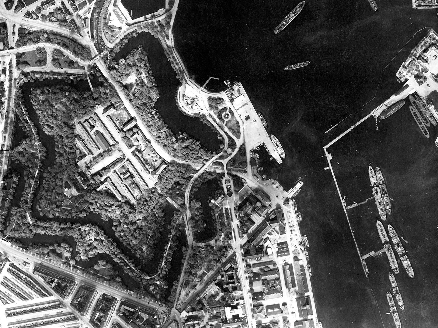
Built on the site of an earlier redoubt, Kastellet (The Citadel) was part of a ring of ramparts that encircled Copenhagen; Collection: ACIU, Sortie: 106G/LIB/0017, Frame: 3068 (12 May 1945)
Engineering the Perfect Defence
Every angle of the star-shaped design served a specific defensive purpose. Projecting bastions allowed defenders to direct artillery fire along the surrounding walls, creating overlapping fields of fire and eliminating areas where approaching attackers could otherwise remain hidden.
Additional defensive features, including deep ditches or moats, ravelins (triangular fortifications) and outer earthworks provided further protection. Rather than relying on height, these fortifications used carefully calculated geometry and multiple defensive layers to withstand enemy attacks.
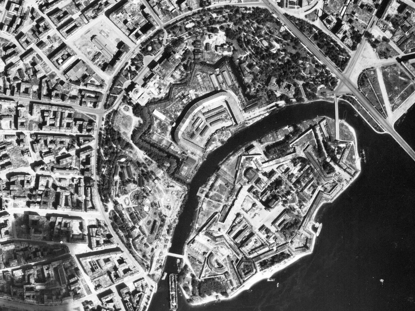
The Peter and Paul Fortress in Saint Petersburg was founded by Peter the Great in 1703, and was heavily damaged by the Luftwaffe; Collection: NARA, Sortie: GX/03235, Frame: 0153 (21 July 1943)
During the seventeenth century, the design was further developed by military engineers across Europe. Among the most influential was French engineer Sébastien Le Prestre de Vauban (1633-1707), whose fortification designs and improvements helped establish new standards in military architecture. His influence can still be seen in numerous surviving fortresses, several of which are now recognised as UNESCO World Heritage Sites.
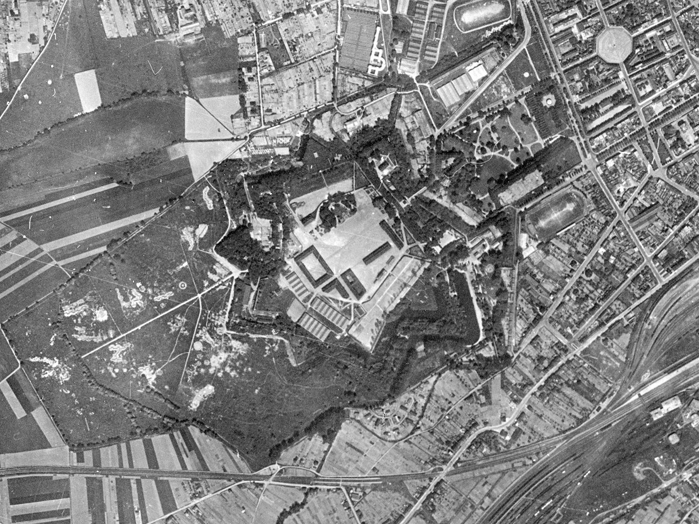
The Citadel of Arras was begun by Vauban in 1668, remaining a military site until its addition to the UNESCO World Heritage List in 2008; Collection: NARA, Sortie: TUGX/2282, Frame: 0672 (30 May 1939)
Although advances in artillery eventually reduced the effectiveness of traditional bastioned fortifications – including star forts – their influence on military architecture endured for centuries.
Reading the Landscape from Above
Today, aerial photography provides an invaluable perspective for understanding these important historic and archaeological landmarks. Viewed from above, the geometric precision of star forts becomes particularly apparent, revealing the relationship between their bastions, defensive walls, surrounding ditches and wider landscape.
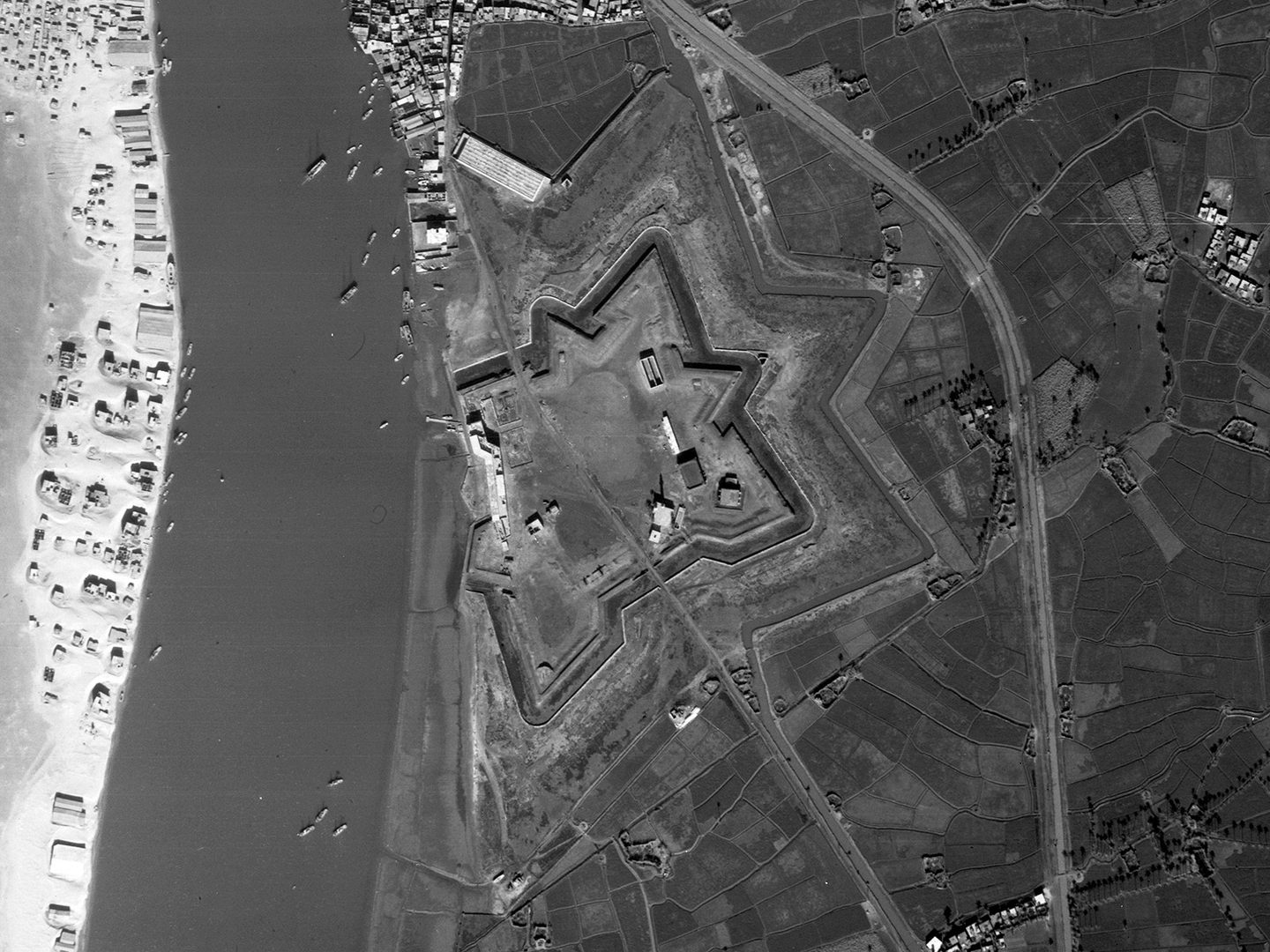
Today, the Orabi Fortress near Damietta, Egypt has been swamped by urban expansion and its walls and buildings have deteriorated; Collection: JARIC, Sortie: 13/RAF/1663, Frame: 0187 (04 January 1954)
Historical aerial photographs can also provide evidence of how these fortifications have changed over time. Urban expansion, agricultural activity and modern infrastructure have transformed many historic sites, sometimes obscuring features that were once clearly visible. By comparing aerial photographs taken across different decades, it is possible to investigate the changing appearance of these landscapes and identify features that may no longer survive above ground.
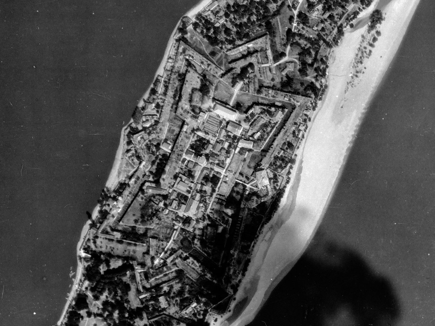
The star fort of Ada Kaleh on the Danube was submerged in 1970 during the construction of the Iron Gates Hydroelectric Plant; Collection: NARA, Sortie: TUGX/1430, Frame: 0518 (09 April 1940)
Star forts remain striking reminders of how warfare, engineering and landscape have changed over time. Through the continuous digitisation and upload of historical aerial photographs to the NCAP website, these remarkable structures can continue to be documented and explored through new perspectives, helping us to understand both our military history but also the changing landscape of our world today.
Isabella Taylor, NCAP Metadata Assistant
How Aerial Surveys Reveal Vanished Landscapes Hong Kong Aerial Imagery Dating Back to 1924