Rediscovering the Nile: How Aerial Surveys Reveal Vanished Landscapes
For millennia, the River Nile has shaped human civilisation, sustaining communities, agriculture and trade across North and East Africa. Today, however, much of its landscape has been irrevocably altered by modern engineering and development.
NCAP preserves images captured for the Geographical Section, General Staff (GSGS, also known as MI4) decades before the construction of the Aswan High Dam transformed the Nile and its surrounding lands. The imagery was deposited with NCAP by the Defence Geographic Centre, a successor body of the GSGS. Together, this imagery offers a rare opportunity to rediscover the Nile as it once was.
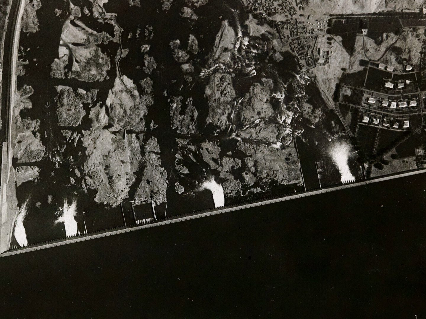
The Aswan High Dam was built on this site in 1960; Collection: DGC, Sortie: GSGS/EGYPT/NILE, Frame: 0019 (02 May 1934)
Mapping the Nile: The Defence Geographic Centre
This aerial photography of the Nile Valley was undertaken for the GSGS as part of a wider programme to produce accurate and up-to-date mapping for British and Commonwealth forces. During the late 1930s, aerial survey had become an essential tool for military planning, navigation and territorial administration, offering a level of precision that ground-based surveys alone could not achieve.
Flying over Egypt and Sudan, survey aircraft systematically photographed vast stretches of the Nile Valley. These images formed the baseline data used to create maps for operational and logistical use, capturing settlements, transport routes, cultivated land and the river’s shifting channels. While originally produced for military purposes, the photographs now hold far greater significance beyond their initial intent.
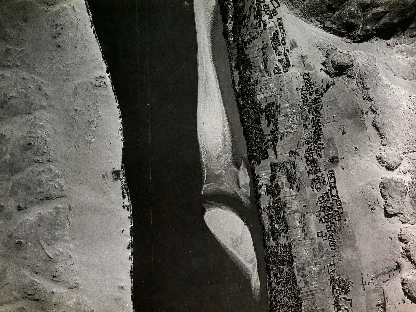
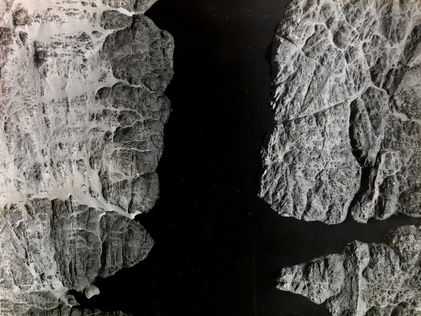
A settlement located by the modern Abu Simbel Airport, now flooded beneath Lake Nasser; Collection: DGC, Sortie: GSGS/EGYPT/NILE, Frame: 0397 (02 May 1934)
The Nile Before the Aswan High Dam
One of the most striking aspects of this imagery is its temporal position. The photographs predate the construction of the Aswan High Dam in the 1960s, a project that permanently reshaped the Nile and its surrounding environment.
The dam’s creation – built primarily to provide consistent water for irrigation and generate significant amounts of hydroelectric power – led to the formation of Lake Nasser, submerging extensive areas of land, displacing over 100,000 people and altering long-established patterns of flooding and sediment deposition.
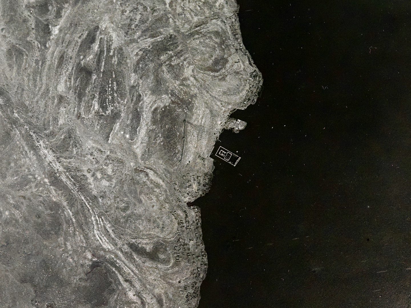
Agilkia Island, now home of the Sanctuary of Isis at Philae; Collection: DGC, Sortie: GSGS/EGYPT/NILE, Frame: 0007 (02 May 1934)
Numerous ancient Nubian monuments and archaeological sites were also under threat due to the flooding. This led to the International Campaign ‘Save the Monuments of Nubia’ which launched in 1960 by UNESCO to safeguard Nubian heritage. Monuments such as the famous Abu Simbel temples and the Philae temple complex were successfully dismantled and moved to higher ground to ensure their preservation.
Understanding Land Use and Change
Beyond their historical value, the 1938 aerial photographs are of critical importance for contemporary geographical and environmental research. As a baseline dataset, they allow researchers to track long-term land use and land cover change along the Nile corridor. By comparing these early images with later aerial photography and satellite-derived imagery, scholars can identify shifts in agriculture, urban expansion, river morphology and desert encroachment.
Such comparisons are essential for understanding the environmental consequences of dam construction, population growth, and climate variability. They also support work in hydrology, archaeology and heritage management, helping to locate former river channels, ancient settlements and agricultural systems that have since been obscured or erased.
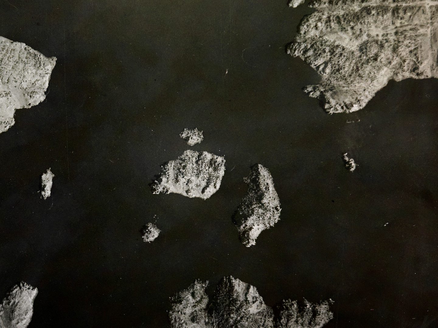
This area is now flooded, leaving an island to where several Nubian sites were relocated, including the Temple of Kalabsha; Collection: DGC, Sortie: GSGS/EGYPT/NILE, Frame: 0021 (02 May 1934)
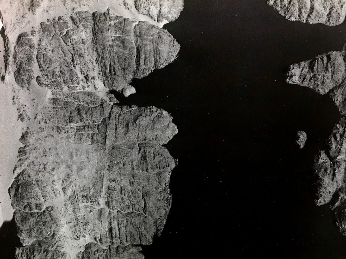
The original site of the complex of the Temple of Kalabsha, c.50km south of its new home on the island of New Kalabsha; Collection: DGC, Sortie: GSGS/EGYPT/NILE, Frame: 0096 (02 May 1934)
Preserving a Vanished Landscape
The Nile Valley imagery within NCAP is a powerful reminder of the role aerial photography plays in preserving landscapes that are vulnerable to change. What began as a military mapping exercise has become a lasting visual archive, enabling new forms of research and reinterpretation decades later.
By rediscovering the Nile through these photographs, we gain not only insight into the past geography of one of the world’s most important rivers, but also a deeper understanding of how human intervention continues to shape landscapes over time. In this way, the collection stands as both a historical record and an essential resource for addressing present and future questions about land use, development and environmental change.
Isabella Taylor, NCAP Metadata Assistant