
Image courtesy the Medmenham Collection
Allied Central Interpretation Unit Z Section at Danesfield House in 1945.
Image courtesy the Medmenham Collection
Our History
As an official custodian of British military-declassified aerial photography, alongside civilian-flown air surveys, the National Collection of Aerial Photography (NCAP) is one of the world’s largest and most significant collections of historical aerial imagery. Our collection dates back over 100 years to 1924, when the oldest images we hold were taken.
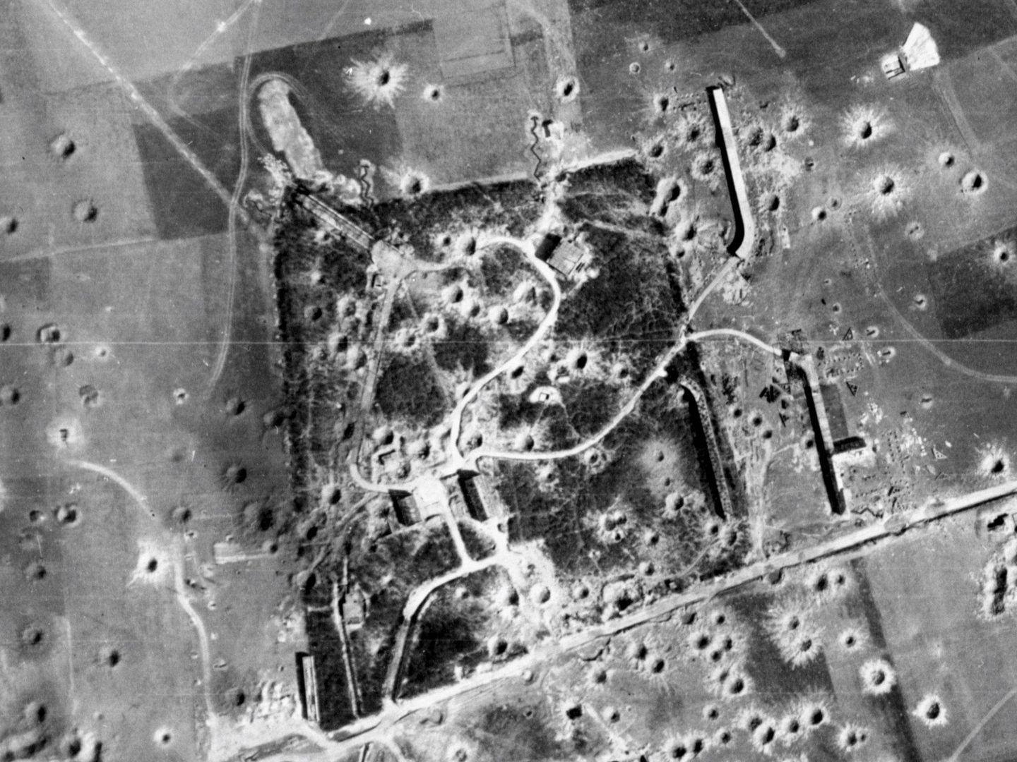
The origins of NCAP are rooted in the development of the Allied Central Interpretation Unit (ACIU), at RAF Medmenham, during the Second World War. The evolution of the ACIU as an industrial-scale intelligence agency was pivotal to the war effort and established the foundation for modern Photographic Intelligence. People had experimented with aerial photography from as early as 1858, and it had been used extensively for intelligence gathering during the First World War, but was largely neglected by the intelligence services in the inter-war years.

In 1938, with conflict looming, the Secret Intelligence Service (MI6) commissioned aviator Sidney Cotton to take clandestine photographs of German preparations for war from his private aircraft. From these tentative beginnings, what eventually became the ACIU was formed. The Photographic Interpreters (PIs) of the ACIU analysed and interpreted millions of aerial photographs during the war.

This imagery records key moments from the conflict. It includes reconnaissance for the Combined Bomber Offensive, the D-Day landings, and Operation Crossbow, the search for German secret weapons.
After the end of the Second World War, there was considerable uncertainty as to what should be done with the millions of images held at RAF Medmenham. Eventually, in the early 1960s, a portion of this imagery (about 5.5 million photographs) was transferred to the University College of North Staffordshire (now Keele University) as an official Place of Deposit under the Public Records Act. The Aerial Reconnaissance Archives (TARA), as this collection would become known, was the forerunner to NCAP.
Fifty years later the collection grew significantly through acquisitions of material from civilian air survey companies and government departments. In 2004, the Ministry of Defence declassified and released millions of additional images relating to British interests during the Second World War and Cold War, further growing the size of the collection.
A few years later, in 2008, the collection was transferred to the care of the Royal Commission on the Ancient and Historical Monuments of Scotland (RCAHMS), where it was merged with the 1.5 million strong former holdings of the Scottish Office Air Photographs Unit. Following this merger, the archive was renamed the National Collection of Aerial Photography.
In 2012, NCAP rescued 1.7 million images and associated material produced by the Directorate of Overseas Surveys from the defunct British Empire and Commonwealth Museum, Bristol.
NCAP became a part of Historic Environment Scotland (HES) when it was formed from the merger of RCAHMS and Historic Scotland in 2015. The collection has now grown to over 30 million images thanks to numerous deposits, acquisitions and partnerships.

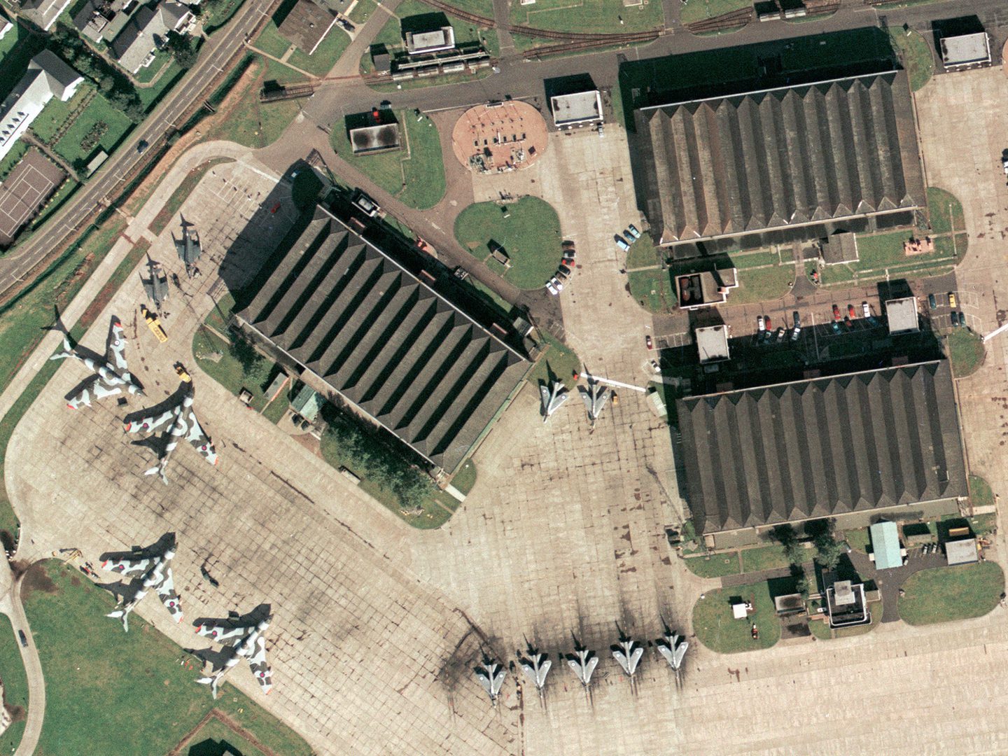
Today, our advanced preservation, digitisation and online dissemination capabilities allow for millions of images from our collection and those of our partners to be made available. Our digital imaging processes provide images for a range of applications as diverse as the locating of unexploded ordnance, global-scale climate change and research across a growing range of academic disciplines.
Through collaboration with stakeholders and partners, NCAP is firmly established as a centre of excellence, and we are setting new standards for the preservation, digitisation, and applied use of historic aerial imagery. From our wartime origins to our state-of-the-art present, our history makes us perfectly placed to serve the needs of clients and partners around the world today.
IN THIS SECTION

Our Mission
With a responsibility for 30 million aerial photographic images, our goal is to preserve them and make them accessible for present and future generations.

Our Team
Meet the team of dedicated technicians, historians, analysts, cataloguers, data managers and robots who deliver NCAPs collections to the public every day.

Our Partners
We collaborate with organisations from around the world with the common goal of facilitating access to aerial photographic collections.

Release Notes Overview
Explore newly released aerial imagery on our online portal, with detailed summaries of each batch from NCAP and partner collections.

Operating Model
The operational and development costs of NCAP are funded through commercial income generation and grant funding.

Volunteer
Growing our network of partners includes reaching out to a knowledgeable and engaged public for volunteer opportunities.