Aerial Photography, Golf and Royal Troon
Operation REVUE
The UK-wide aerial photographic survey flown between 1945 and 1951 by the Royal Air Force – Operation REVUE – generated c.280,000 aerial photographic images of Scotland alone, providing comprehensive coverage. At NCAP, these are held alongside further imagery created from the 1940s to the early 21st century. Altogether, this collection of 1.5 million images provides over half a century of comparative cover of Scotland.
These surveys were usually intended to assist the Ordnance Survey, town planners or infrastructure development. However, in repeatedly covering the whole of Scotland there is inevitably extensive coverage within the resulting imagery of a wide range of other areas of interest.
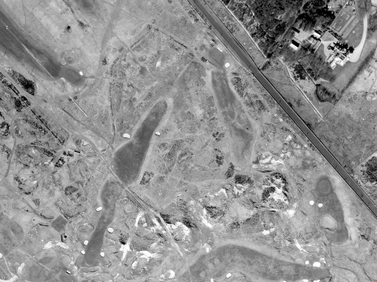
Royal Troon Golf Club's 12th Hole - The Fox - in 1946; Collection: SCOT, Sortie: 106G/SCOT/UK/0003, Frame: 7042 (10 April 1946)
Golf Courses
Something recorded frequently during aerial photographic surveys is golf courses. While it is hard to come to an exact figure, it is estimated that today there are c.2,500 golf courses across the UK as a whole, with c.550 of those in Scotland alone. Many of these courses have been photographed repeatedly during numerous commercial aerial surveys across the decades.
By their nature, Scottish links golf courses are invariably sited adjacent to potential invasion beaches, and therefore also feature in our military-declassified holdings as a result of defence planning (and possibly occasional requests from golf-inclined RAF Group Captains) during and after the Second World War. Aerial photography is thus a valuable tool in recreating the history of golf course evolution, as well as tracking the impact of climate change on coastal erosion at golf courses.
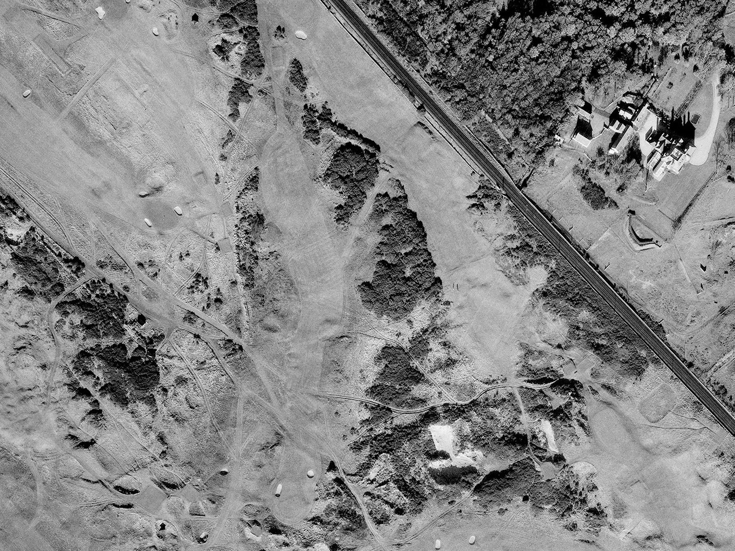
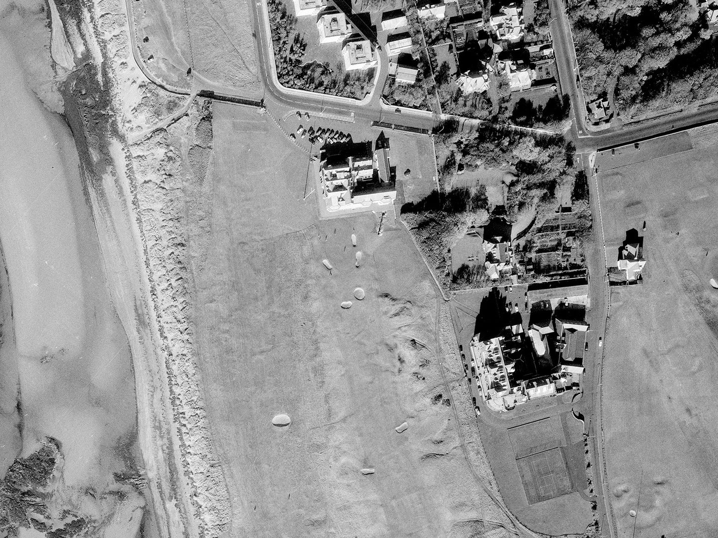
By 1971, Royal Troon's 12th Hole has become longer, with a slight dogleg and significantly more growth around it; Collection: SCOT, Sortie: MER/160/71, Frame: 0039 (25 October 1971)
Royal Troon Golf Club
One of the world's premier links championship courses is Royal Troon Golf Club on the west coast of Scotland. Established in 1878, Royal Troon has hosted The Open Championship 10 times since 1923, growing and developing extensively over the years. Major layout changes to the Old Course at Royal Troon took place in the mid-1940s and early 1970s, in response to longer hitting by golfers and the desire of the Royal and Ancient (one of golf's worldwide governing authorities) to ensure courses remained challenging.
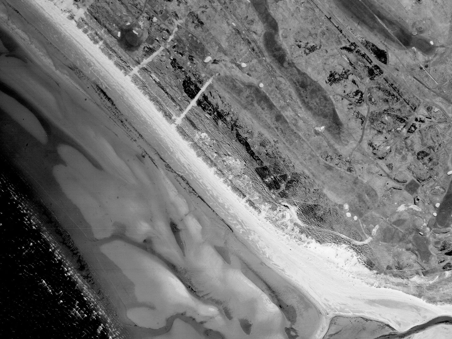
The 6th Hole - Turnberry - at Royal Troon Golf Club in 1946; Collection: SCOT, Sortie: 106G/SCOT/UK/0003, Frame: 7043 (10 April 1946)

25 years on, Turnberry has been lengthened significantly, almost reaching to the banks of the Pow Burn; Collection: SCOT, Sortie: MER/160/71, Frame: 0038 (25 October 1971)
A Changing Landscape
NCAP holds imagery from several sorties flown over Troon in 1946 and 1971 which illustrates these changes. A gallery of NCAP images at Royal Troon Golf Club places details of the Old Course from images taken during these sorties alongside more contemporary imagery from 2024 (showing yet more adaptations). Comparisons across the years reveal fascinating insights into how holes have developed and changed over time. The 6th Hole – Turnberry – is noticeably significantly longer in 1971 than it was in 1946, for example, while the 12th Hole - The Fox - changed shape entirely.
While these examples show changes at Royal Troon Golf Club specifically, there will undoubtedly be many other clubs around the country (and world) for which a similar exercise could be undertaken. It is yet another illustration that the aerial photography taken decades ago during surveys like Operation REVUE continues to demonstrate its use and relevance today.
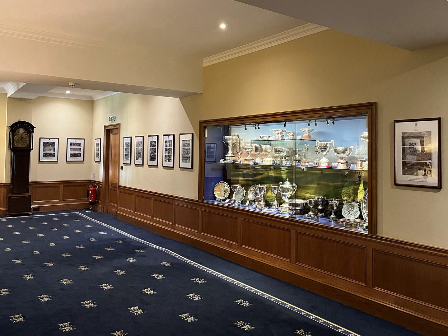
NCAP images on display at Royal Troon Golf Club; Image courtesy Ian Robertson
The creation of a gallery of aerial images at Royal Troon Golf Glub was the brainchild of Ian Robertson. A member of the Royal Troon Golf Club, Ian discovered the work of NCAP when he served as a Trustee and board member of Historic Environment Scotland. The NCAP team are grateful for the guidance and support that Ian provided to our commercial growth and development during his tenure and are delighted that NCAP imagery now features in the clubhouse at Royal Troon Golf Club.
Ben Reiss, NCAP Collections Manager