Royal Commission on the Ancient and Historical Monuments of Wales Collaboration
Since 2024, the National Collection of Aerial Photography (NCAP) has been working with the Royal Commission on the Ancient and Historical Monuments of Wales (RCAHMW). The aim of our venture with them is to digitise and catalogue the extensive collection of aerial photography they are custodians of. The collaboration will ensure this unique imagery is made accessible and preserved for the future.
The Royal Commission on the Ancient and Historical Monuments of Wales
The Royal Commission on the Ancient and Historical Monuments of Wales (RCAHMW) was founded in 1908 in the wake of the Ancient Monuments Protection Act of 1882. The 1882 Act encouraged landowners across the United Kingdom to voluntarily transfer ownership of (principally prehistoric) monuments of historic significance to the care of the Crown. However well-intentioned, this was hampered by limited existing information.
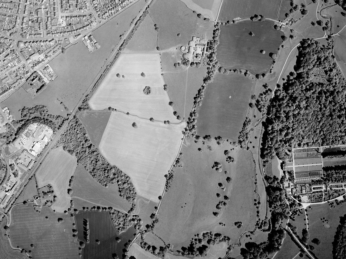
The scheduled monuments of Bersham Colliery (left) and Wat's Dyke (along the woodland) as well the 18th century Erddig Hall (right); Collection: RCAHMW, Sortie: OS/97/0172, Frame: 0089 (30 May 1997)
By 1908, the need for a comprehensive census of archaeological sites – both ancient monuments and later built heritage – was clear, and Royal Commissions for this purpose were set up in England, Scotland and Wales. Today, RCAHMW has a leading role in developing and promoting understanding of the archaeological, built and maritime heritage of Wales, holding a unique collection of photographs, maps, images, publications and reports within The National Monuments Record of Wales.
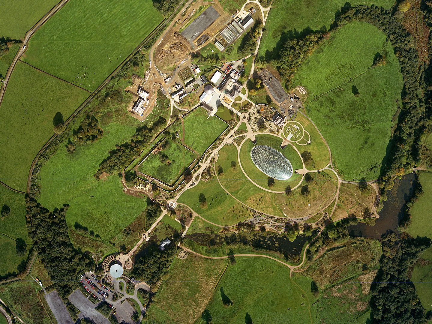
The National Botanic Garden of Wales shortly after opening, with the prominent Great Glasshouse designed by Foster and Partners; Collection: RCAHMW, Sortie: OS/01/1013, Frame: 1567 (28 August 2001)
Aerial Photography
Within this important archive are c.1 million aerial photographs covering the whole of Wales. These were largely produced by the Royal Air Force (RAF) and Ordnance Survey. A large proportion of the earliest aerial images held by RCAHMW were produced during Operation REVUE, a significant air survey of the whole United Kingdom carried out by the RAF, to inform the revision of maps and post-war reconstruction.
In addition to vertical and oblique imagery created by the RAF in the decades that followed during reconnaissance missions, the archive also contains high-resolution vertical imagery created by the Ordnance Survey for the systematic creation of topographic mapping. Together, this imagery provides a valuable record of the changing Welsh landscape through the second half of the twentieth century.
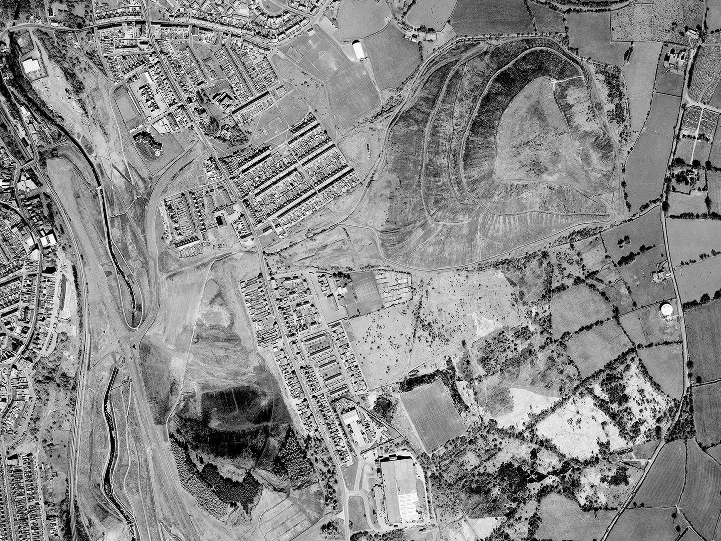
The site of the Bargoed Colliery (closed 1977). Today, there is a park on the remains of what was one of the largest colliery tips in Europe; Collection: RCAHMW, Sortie: OS/97/0088, Frame: 0206 (1997)
A particular feature of the Welsh landscape is the legacy of mining. Mining for slate, metals and particularly coal has taken place in Wales since before the arrival of the Romans. In the decades after the Second World War, the Welsh coal mining industry entered steep decline. It has left an indelible mark on the landscape, however, one which is clearly visible in aerial photography.
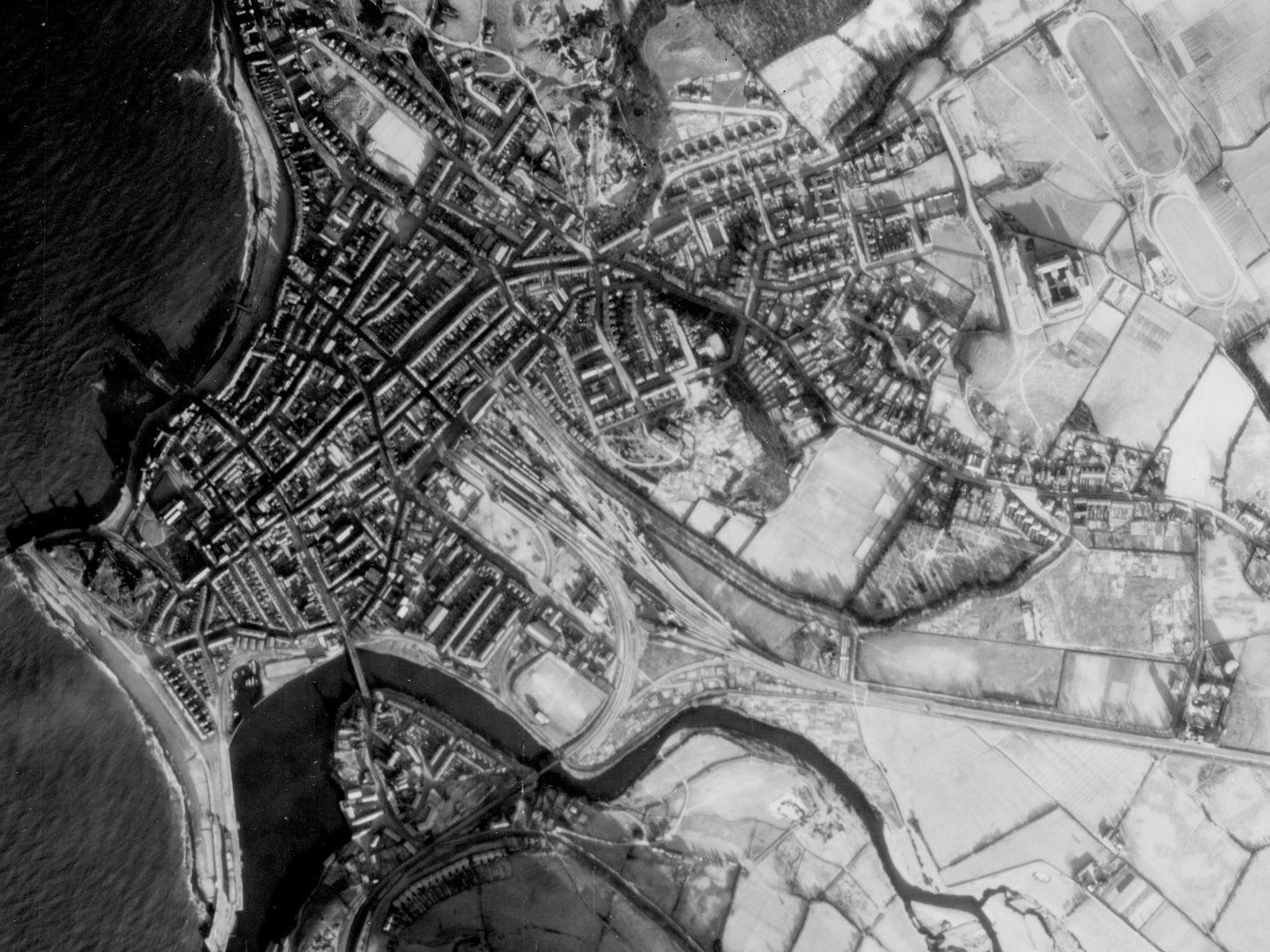
A snowbound Aberystwyth photographed by a German reconnaissance aircraft, with the brand new National Library visible to the right; Collection: NARA, Sortie: GX/12032, Frame: SG_0169 (02 January 1941)
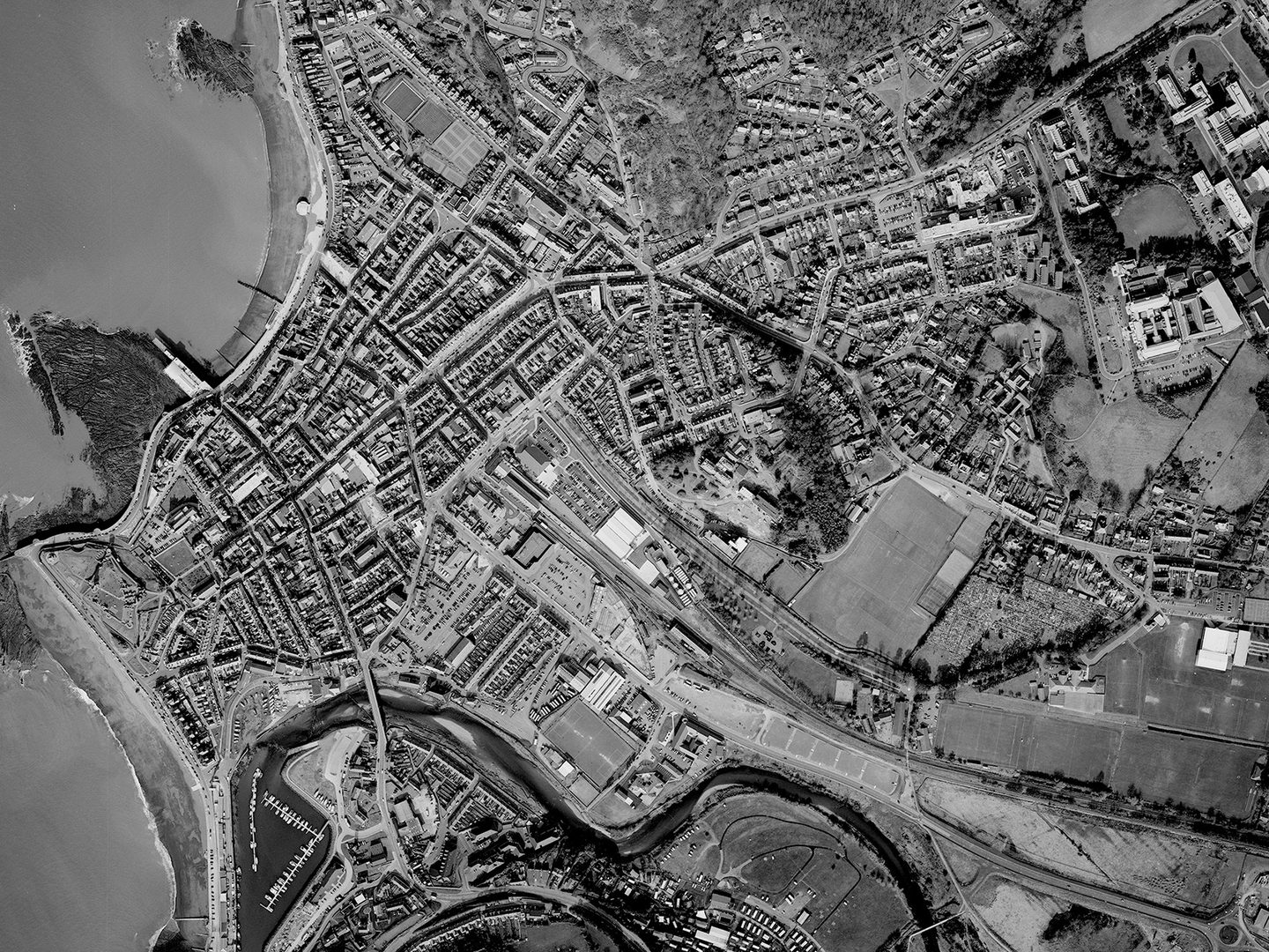
Aberystwyth 56 years later, showing the developments which had taken place to the west of the town and around the National Library; Collection: RCAHMW, Sortie: OS/97/0034, Frame: 0028 (1997)
Collaboration
In 2024, NCAP and RCAHMW began work digitising these aerial photographs. Thanks to this collaboration, access to tens of thousands of images that record places throughout Wales will be preserved, rehoused, digitised and made accessible online for the first time via our online platform. There they will sit alongside significant existing coverage of Wales already held and disseminated by NCAP, including Second World War-era Luftwaffe (German Air Force) reconnaissance coverage of the country, digitised and published in partnership with the US National Archives and Records Administration.
Ben Reiss, NCAP Collections Manager
Find out more about our collaboration