Operation REVUE
In the immediate aftermath of the Second World War, the Air Ministry directed the Royal Air Force (RAF) to undertake Operation REVUE, a comprehensive aerial photographic survey of the United Kingdom. Running from 1945 to 1951, it led to the creation of an invaluable resource for post-war reconstruction and development of the country.
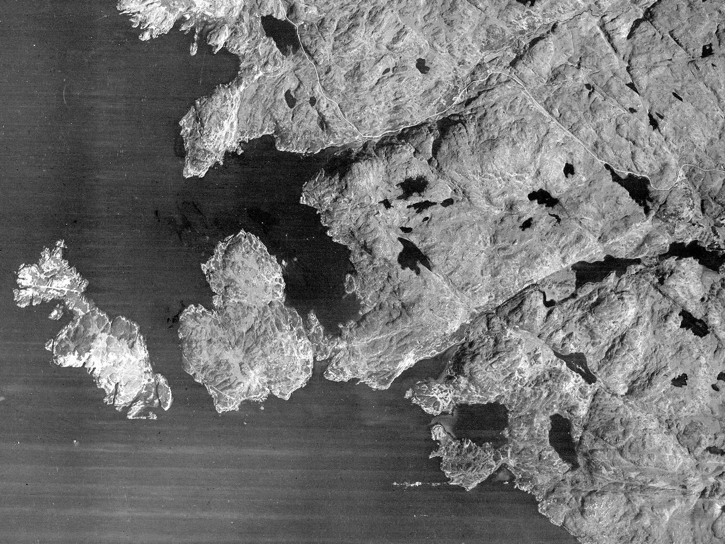
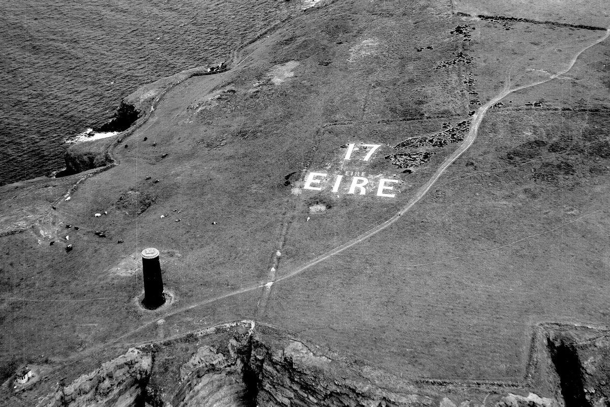
Calbha Beag and Calbha Mòr off the north-west coast of Scotland; Collection: SCOT, Sortie: 106G/SCOT/UK/0077, Frame: 6002 (10 May 1946)
Operation REVUE
The survey was intended to assist the Ordnance Survey in revising its maps of the country, alongside assisting numerous government departments, including those overseeing town planning and transport infrastructure. Designed to produce stereoscopic vertical cover at 1:10,000 scale, with larger scales and oblique photography taken of settlements, the survey was initially scheduled for completion by the end of 1947. However, many areas were re-flown in 1948-49 to rectify deficiencies caused by cloud cover or camera failure.
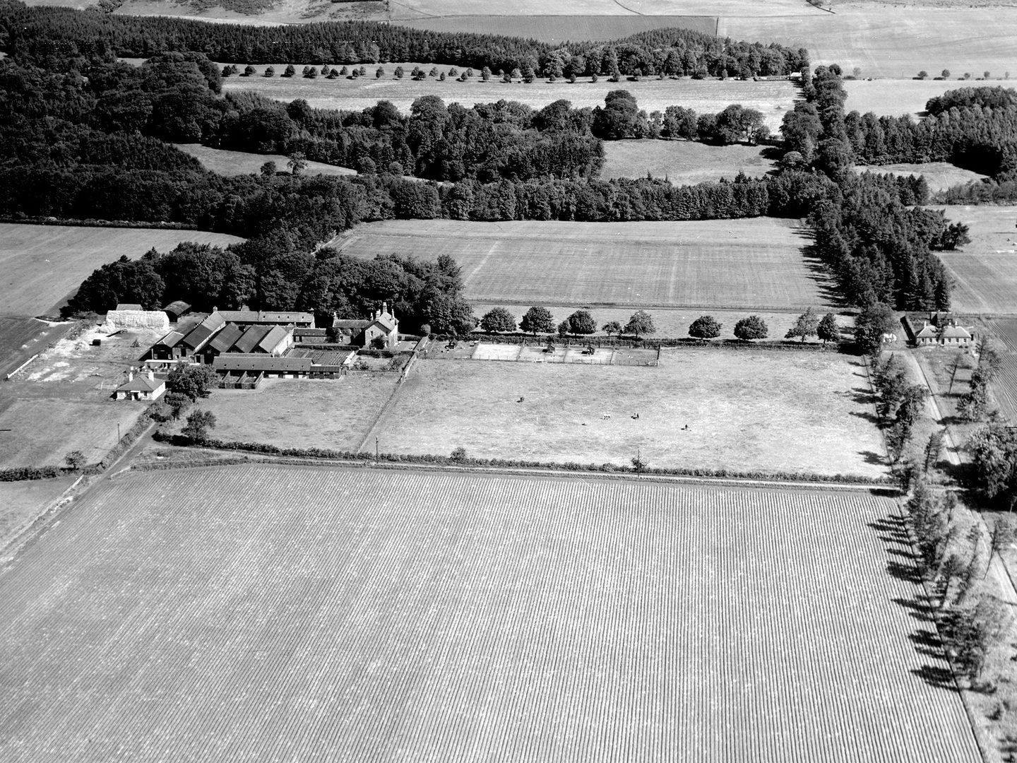
Fields where the South Parks district of the New Town of Glenrothes is today. The farmhouse still survives, surrounded by houses; Collection: SCOT, Sortie: CPE/SCOT/UK/0220, Frame: 0047 (25 June 1947)
New Towns
In Scotland, c.280,000 images were created during 500 REVUE sorties across the length and breadth of the country. These images informed the development of overspill estates – including Castlemilk, Drumchapel, Easterhouse and Pollok in Glasgow – and the New Towns of Cumbernauld, East Kilbride, and Glenrothes.
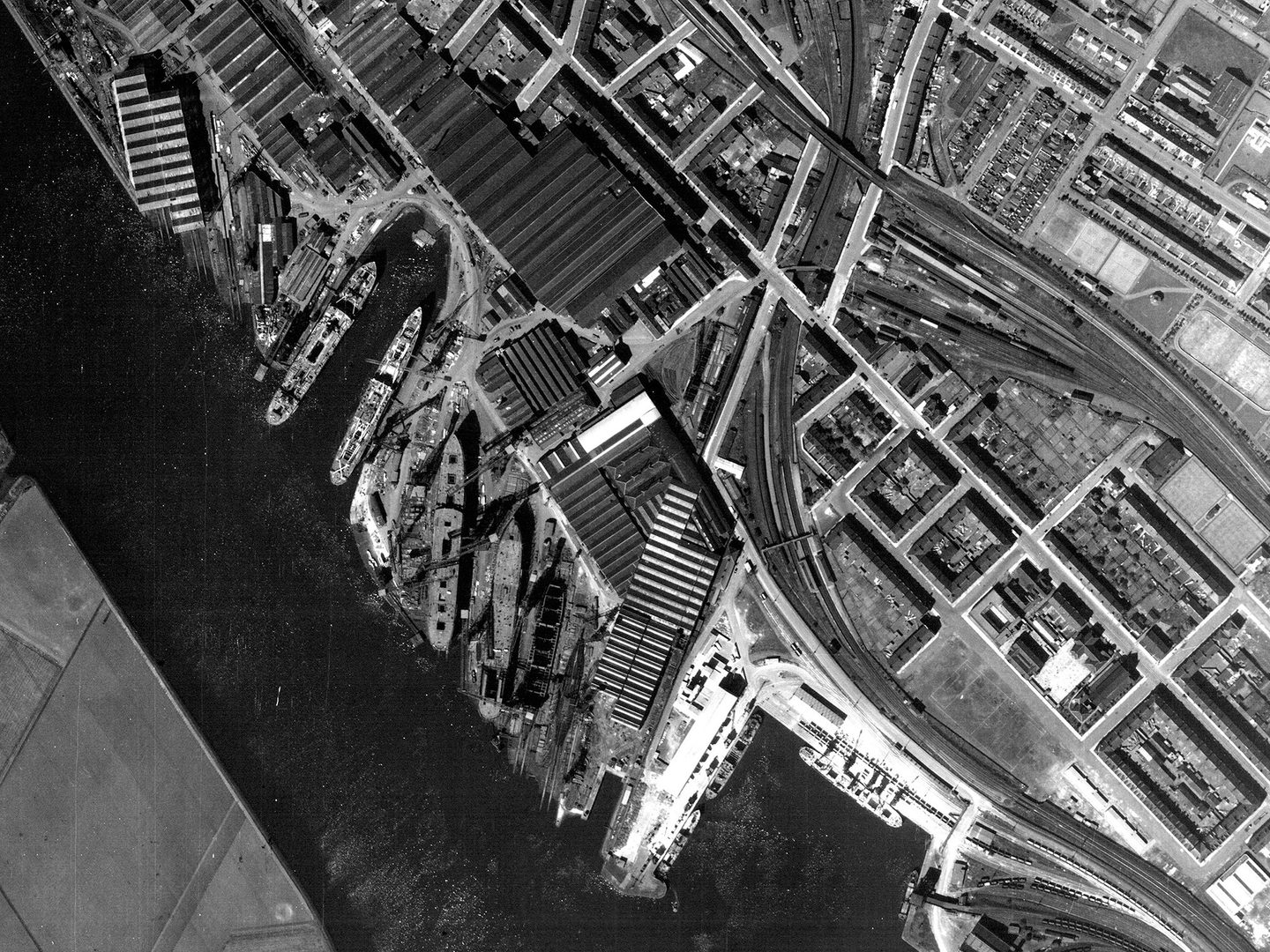
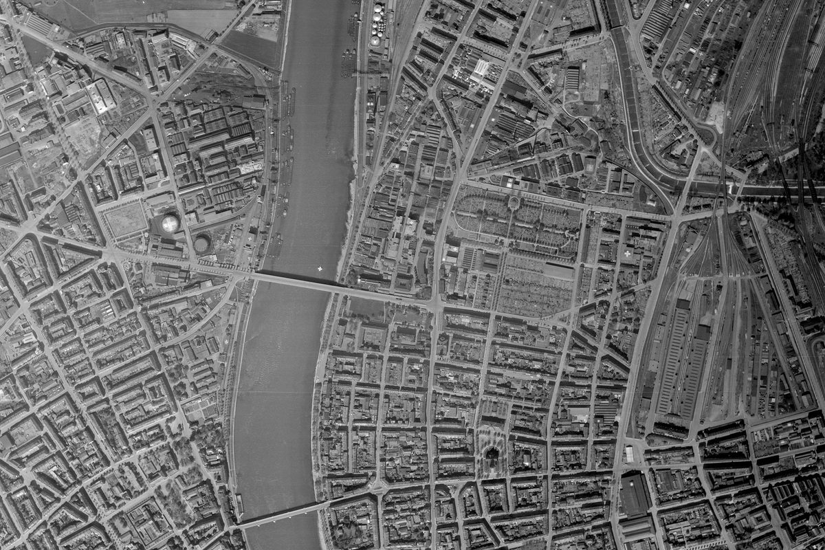
The once world-famous shipyard of John Brown & Company, Clydebank, Glasgow - today, only the Titan Crane is still standing; Collection: SCOT, Sortie: 541A/RAF/0471, Frame: 3172 (10 May 1949)
Old Landmarks
The survey recorded landmarks including Edinburgh's Princes Street Railway station (demolished 20 years later) and shipyards along the River Clyde before its post-war decline and transformation from a world-leading shipbuilding powerhouse into a derelict post-industrial landscape.
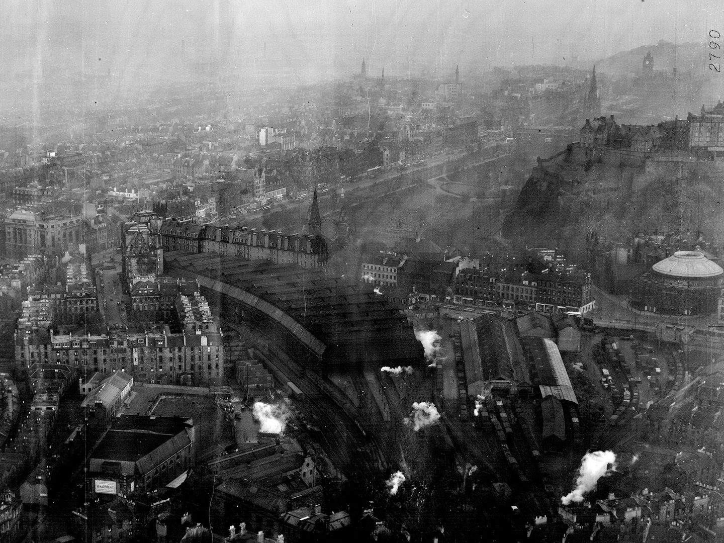
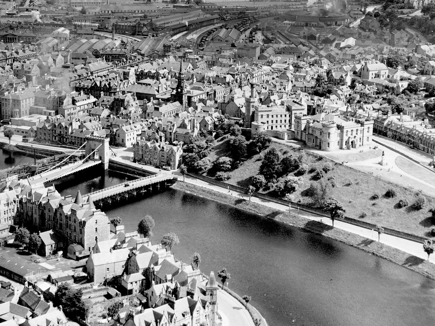
Edinburgh's Princes Street railway station, demolished 1969-70, with Edinburgh Castle and the dome of the Usher Hall to the right; Collection: SCOT, Sortie: 58/RAF/0813, Frame: 0379 (06 December 1951)
While the RAF made great efforts to provide the cover required during Operation REVUE, it experienced some difficulties due to unsuitable aircraft, time-worn equipment and the continual rotation of aircrew. However, the benefits of the survey to a whole range of researchers were, and still are, immeasurable. To those such as farmers, foresters, earth scientists, civil engineers, wildlife managers and archaeologists the images collected from 1945-51 offer a window into the landscape of the mid-20th century and are still in great demand today.
Find out more about our Scottish collections