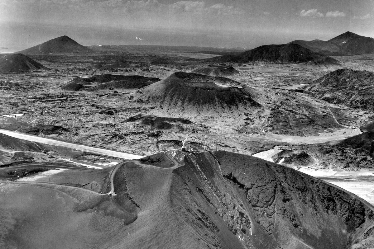
ÉIRE Signs and the Marine and Coast Watching Service
The Marine and Coast Watching Service
To protect against invasion by sea during the Second World War – known as The Emergency in the Republic of Ireland – the Marine and Coast Watching Service was established in 1939. Responsible for identifying and reporting shipping and, later in the war, aircraft movements, the Marine and Coast Watching Service established 83 Local Observation Posts (LOP) along the Irish coast from Ballagan Point in County Louth (No. 1) to Inishowen Head in County Donegal (No. 82), with Foileye Head in County Kerry being No. 83.
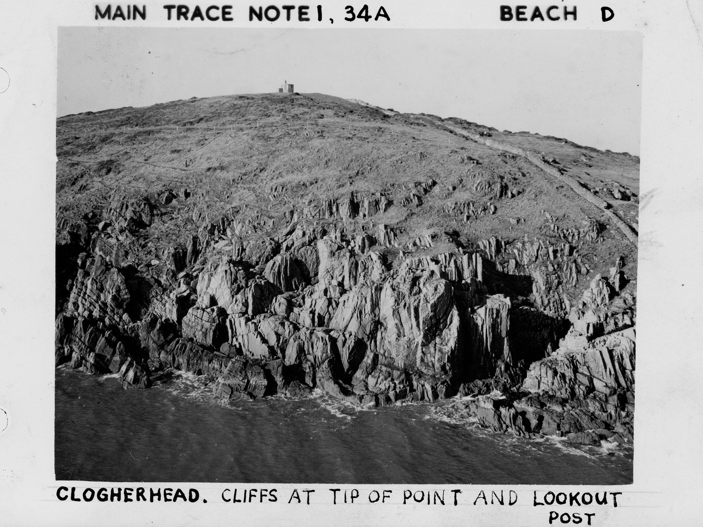
The coast watching hut at LOP 3, Clogher Head; Collection: Irish Military Archives, Sortie: AP/CSY06/0014, Frame: 0001 (November 1948)
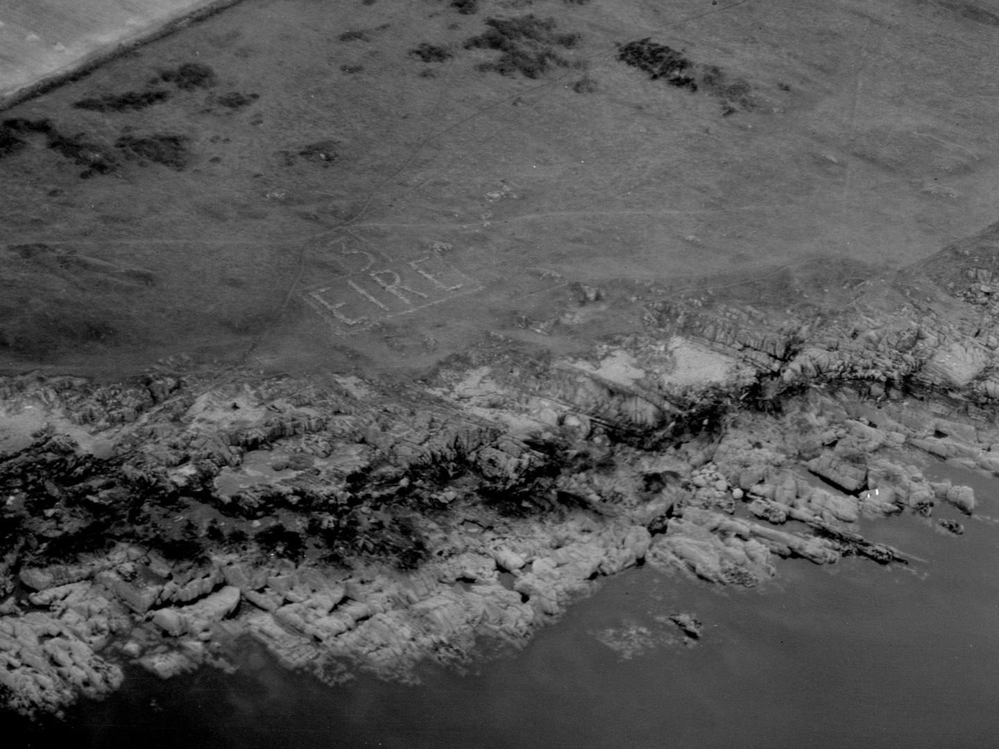
The ÉIRE sign at LOP 3, Clogher Head; Collection: Irish Military Archives, Sortie: AP/0080, Frame: 0087
While the coast watchers were initially left to fend for themselves in the elements, Army tents were distributed, and later huts were constructed, with other abandoned or nearby structures being repurposed into shelter where possible. These shelters provided some protection for a team of coast watchers, primarily volunteers, and contained a telephone to quickly report on any activities in the site’s vicinity.
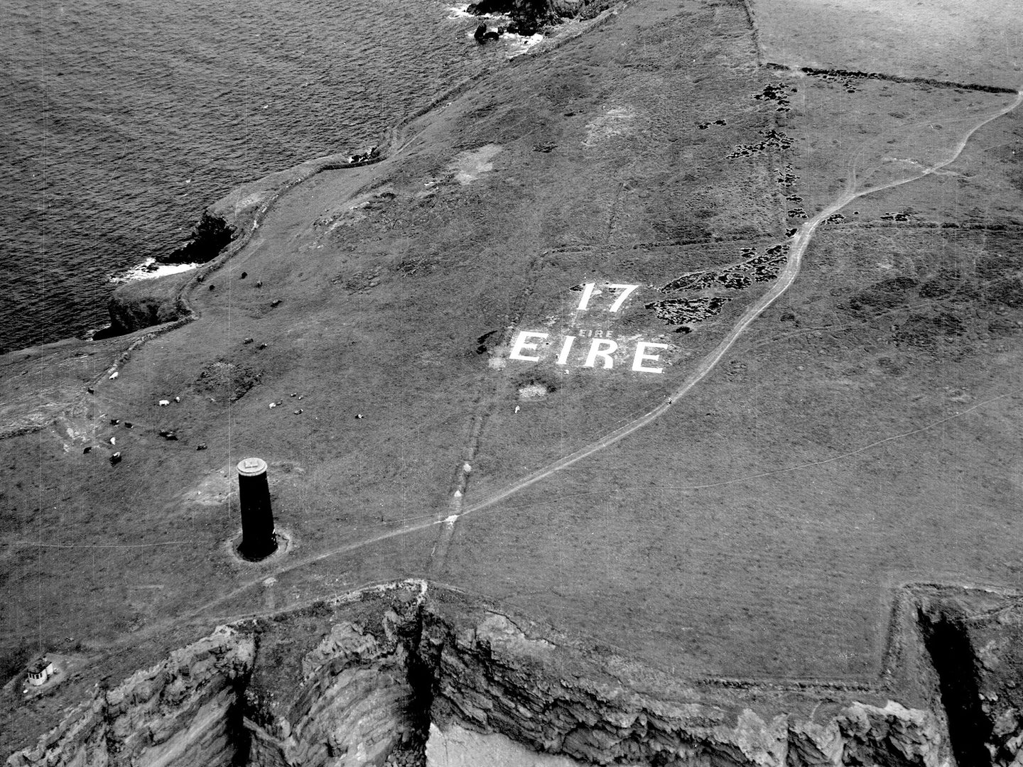
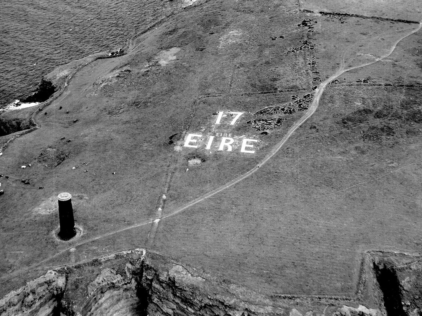
The ÉIRE sign at LOP 17, Brownstown Head; Collection: Irish Military Archives, Sortie: AP/TEMP/0201, Frame: 0013
The coast watchers were generally locals, many of whom were already involved in maritime activities, and were trained in first aid, signalling, maritime practices and ship identification, with aircraft identification added later. Their knowledge of the local area, alongside this training, were crucial to the protection of Ireland’s coastline. Each post had a logbook (examples of which are digitised and available to view) which was rigorously maintained by the coast watchers, and then analysed by Command Intelligence Officers.
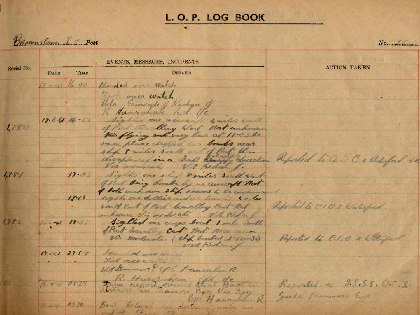
Page 3 from the first logbook from LOP 17, Brownstown Head, noting the sighting of an aircraft that subsequently dropped its bombs nearby; Image courtesy the Irish Military Archives
Many of these logbooks survived and are now held by the Irish Military Archives. They can be seen in the reading room in Dublin, and a limited number have been digitised and made available online.
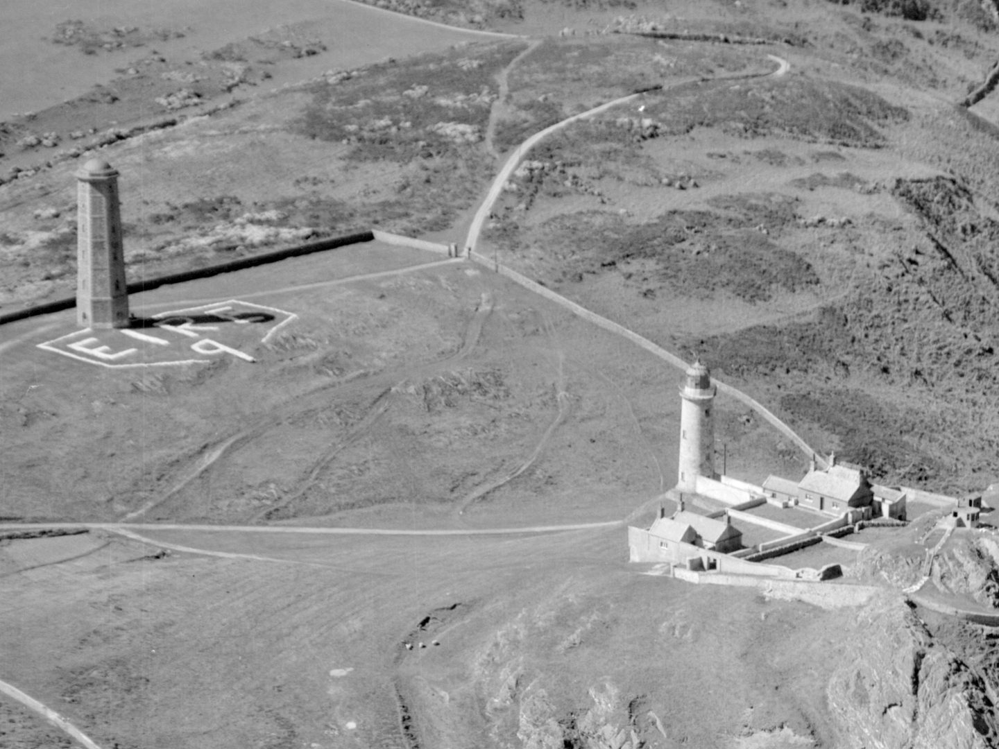
The ÉIRE sign at LOP 9, Wicklow Head, with the Wicklow Head lighthouses visible; Collection: Irish Military Archives, Sortie: AP/LIGHTHOUSES, Frame: 0018
Adding the ÉIRE Signs
In 1943 and 1944, ÉIRE signs made from whitewashed stones were built near each LOP. At an average of twelve meters long and six metres high, these signs, which also showed the associated LOP number, had two purposes. They were a reminder to airmen that they were flying over Ireland, which was neutral airspace, and, for Allied forces with the required maps, the numbers served as aerial navigation waymarkers and allowed them to safely navigate out of Irish airspace.
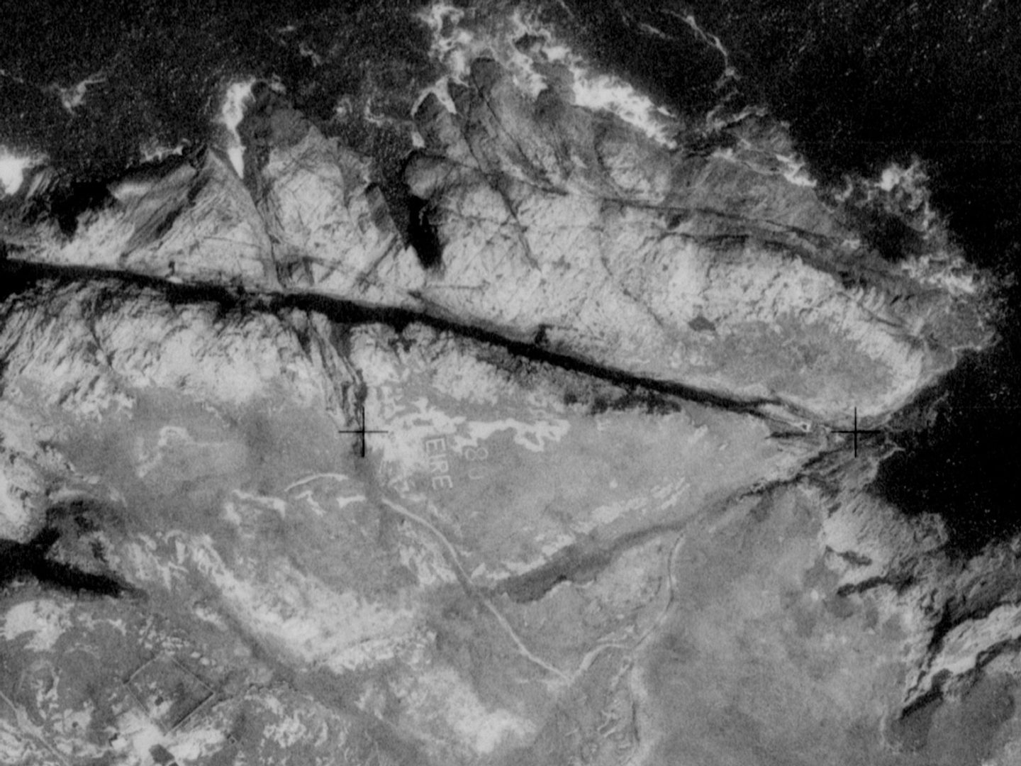
The ÉIRE sign at LOP 80, Malin Head; Collection: Irish Military Archives, Sortie: 1PRU/RAF/1727, Frame: 0014
Not all accidental overflights ended with aircraft being navigated out of Irish airspace, with numerous incidents of force-landing on Irish soil. One of the most notable of these was a Fairey Battle, which went on to be used as a target tug by the Irish Air Corps.
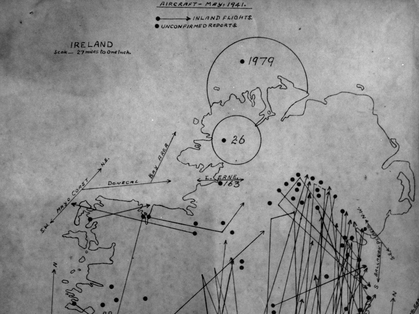
Map of reported overflights in May 1941; Image from the Air Corps Photographic Section, courtesy the Irish Military Archives
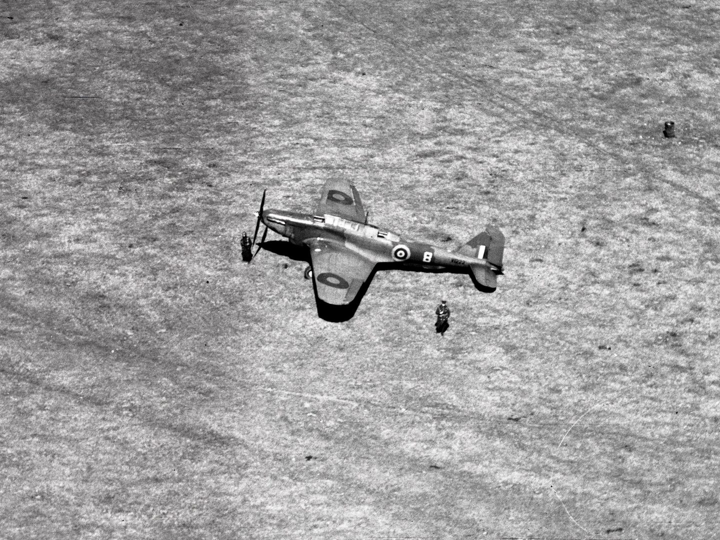
The RAF Fairey Battle which force-landed at the racecourse at Tramore, County Waterford, not far from LOP 17; Image from the Air Corps Photographic Section, courtesy the Irish Military Archives
After the War
After the Marine and Coast Watching Service was dissolved in October 1945, many ÉIRE signs were lost to overgrowth, erosion, and other forces. Dalkey (ÉIRE 7) was already lost to the landscape by the time this photo was taken in September of 1958, but was recovered by members of the Dalkey Tidy Towns Committee in 2018 and is now clearly visible from the air.
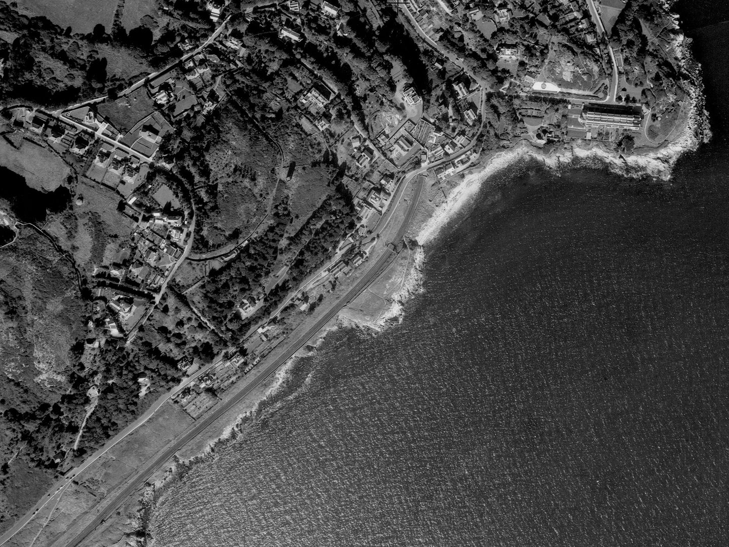
Dalkey, south of Dublin with ÉIRE sign 7 obscured by vegetation; Collection: Irish Military Archives, Sortie: AP/V0252, Frame: 0034 (11 September 1958)
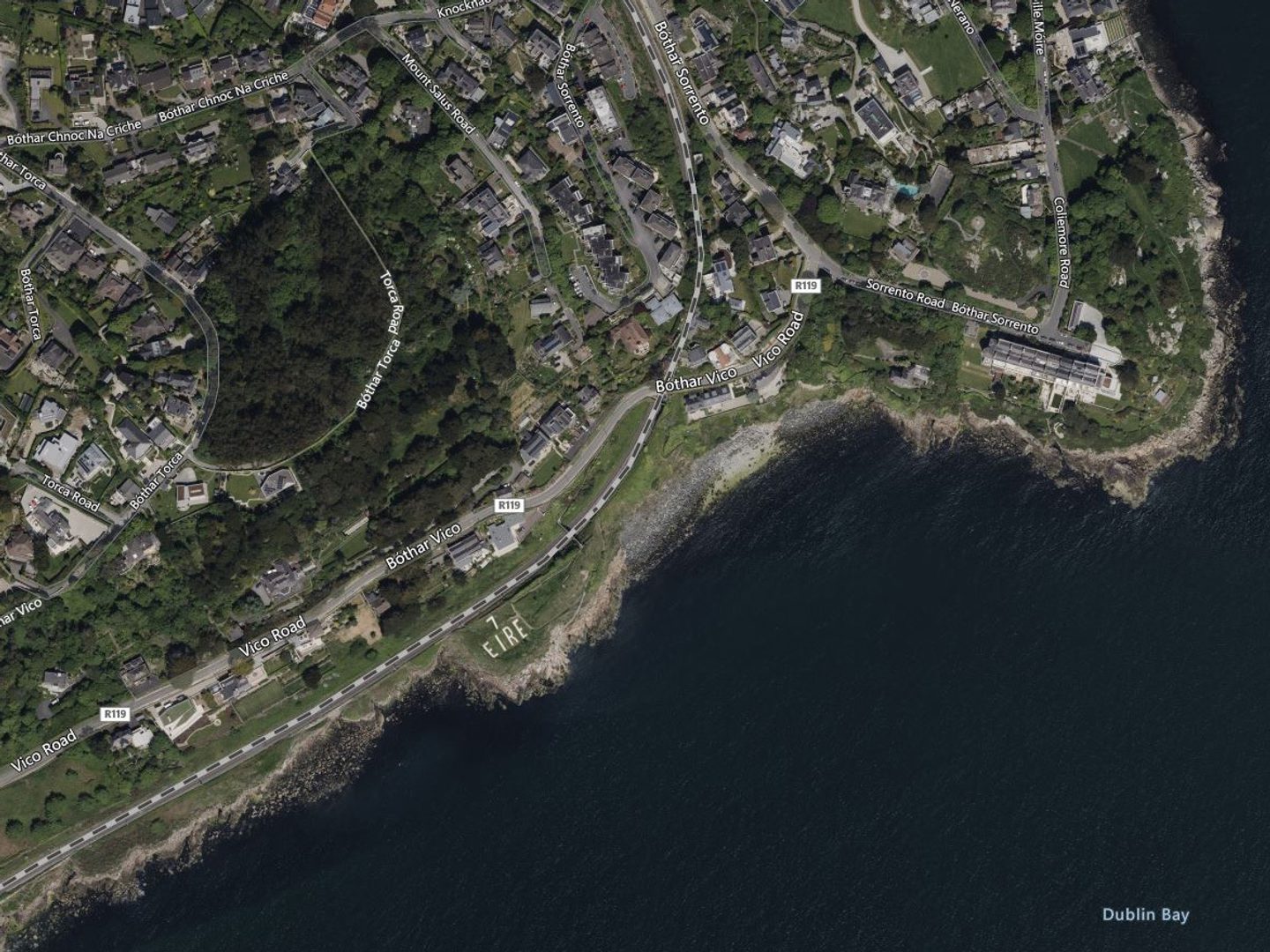
Dalkey today, with ÉIRE sign 7 clearly visible after restoration; Map © Bing Maps
The Legacy Continues
Like the sign at Dalkey, local efforts have seen some of the signs uncovered and restored in recent decades. They can be seen from the air today, and many that have been lost were recorded in the aerial photography held by the Irish Military Archives, which is currently being digitised, footprinted and uploaded to the NCAP website.
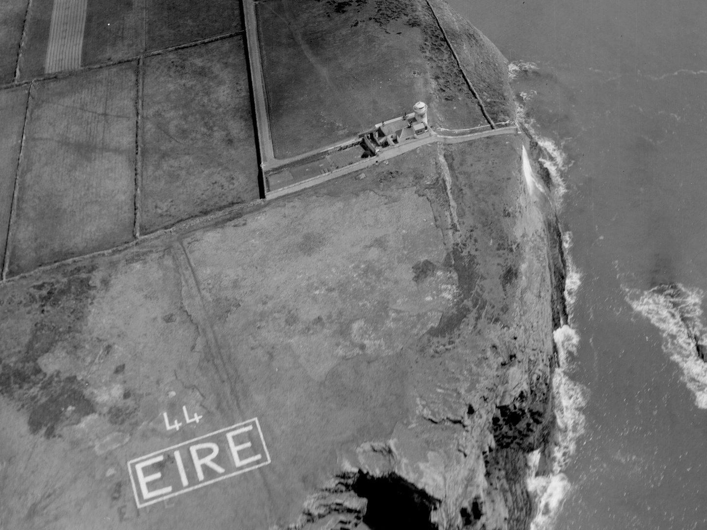
The ÉIRE sign at LOP 44, Kilcreadun Point; Collection: Irish Military Archives, Sortie: AP/LIGHTHOUSES, Frame: 0064
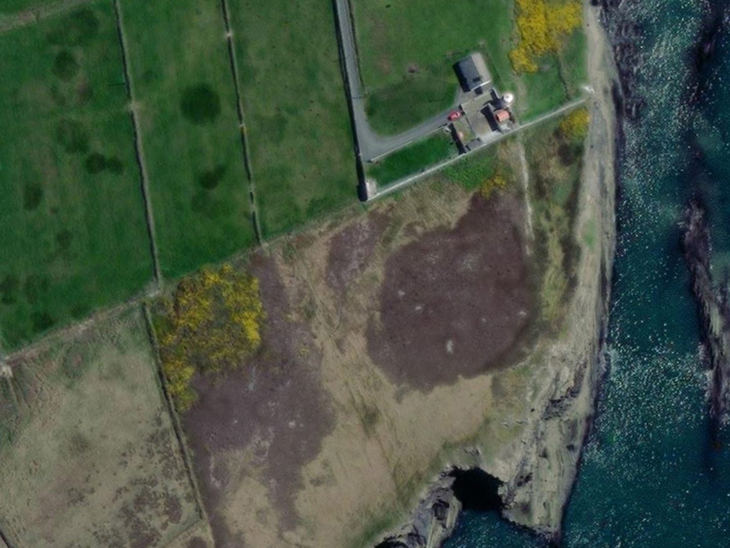
Kilcreadun Point today, showing that ÉIRE sign 44 has been lost; Map © Bing Maps
In an echo of their use as an aerial navigation tool during the Second World War, the ÉIRE signs can prove incredibly helpful to the NCAP metadata team when footprinting images from the Irish Military Archives. Sortie plots, coordinates, and other location information found on films, tins and other associated materials are all used to locate imagery. However, in some cases this information isn’t available, and so the images themselves have to provide the clues. In this instance, the ÉIRE signs provided instantly recognisable location information to aid footprinting.
Ravana Eagleheart, NCAP Metadata Assistant
Irish Defence Forces Partner Page Irish Defence Forces Collaboration Image Release Note 0027