

Understanding Image Quality
Image quality is influenced by a range of factors. Learn how scanning resolution, the physical condition of the original analogue media being digitised, and photograph scale can all impact image quality.
What Resolution Should I Choose?
NCAP imagery is supplied at a range of resolutions depending on the collection and product purchased. Understanding the differences between available resolutions will help you choose the most appropriate product for your project.
Why Do Images Differ?
Images scanned at exactly the same resolution may display very different levels of detail. This is because factors such as flying height, photographic scale and source material often have a greater influence on image quality than the scanning resolution.
Understanding Historic Photography
Many of our collections span decades of technological change. The resources below explain how image quality varies between collections and what level of detail can realistically be expected.
Learn More About:

Choosing the Right Resolution and Format
Understand how image resolution and file formats affect image delivery, file size and usability. This guide explains the options available and helps you choose the most suitable product for your project needs.

Image Quality Factors
Explore the factors that influence image quality, from the condition of the original photograph to scanning methods and image processing. Learn why some images contain more visible detail than others.

Scale and Flying Height
Discover how aircraft flying height and photograph scale influence the level of detail visible within an image. Understanding these relationships will help you assess what information can realistically be identified and interpreted.
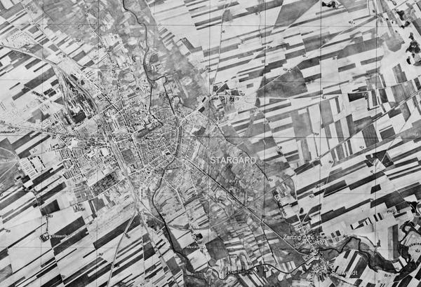
Second World War Imagery
Second World War aerial photography remains one of NCAP's most heavily used collections. Explore its unique characteristics, limitations and strengths to better understand image quality and set realistic expectations for available detail.

Understanding Collection Coverage
Learn why aerial photography coverage varies between locations, periods and collections, and how this can influence the imagery available for your project.

Pre-Digitisation Preservation
Learn how NCAP prepares historic films and prints for digitisation, helping to protect original materials while producing the highest-quality digital images possible.

FAQs
Find answers to some of the most common questions asked of the NCAP team.
IN THIS SECTION

Case Studies
Explore the many new ways historical aerial imagery is being used today.

How-To Guides
Use the step by step guides to help you navigate some of the key tools from the NCAP archive.

Understanding Technical Terms
A glossary of some common technical terms associated with aerial photography.
FAQs
Find answers to some of the most common questions asked of the NCAP team.

Contact Us
Find the best ways to get in touch with the team at NCAP for research support, project partnerships or image sales.

Subscriptions
Subscriptions allow you to zoom images on the website and access finding aids to help identify images.
Newsletter
Sign up to our newsletter to start receiving regular email news updates about NCAP.

Online Sources of Aerial Photography
As well as NCAP, here are some other places you can go for aerial photos and information.